RON HENGGELER |
April 18, 2024
|
||
On April 18,1906 at 5:13 in the morning, San Francisco was struck by an earthquake with an estimated magnitude of 7.9. With water mains and gas lines ruptured throughout the city, fires burned out of control for three days. In the aftermath, the fire destroyed an estimated 28,000 buildings on 490 city blocks. Three quarters of San Francisco had become ash and ruins, and 250,000 residents were left homeless. |
||
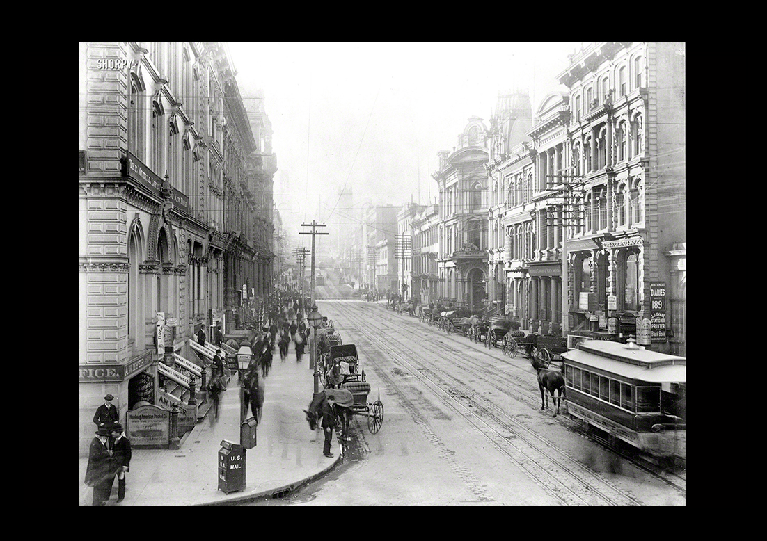
This twelve minute film of a cable car ride down Market Street was made on April 14th, four days before the earthquake struck.Click here: A Trip Down Market StreetThis is the most complete version of the historic film, "A Trip Down Market Street," combining the best elements of prints from Prelinger Arichives and Library of Congress. |
||
|
||
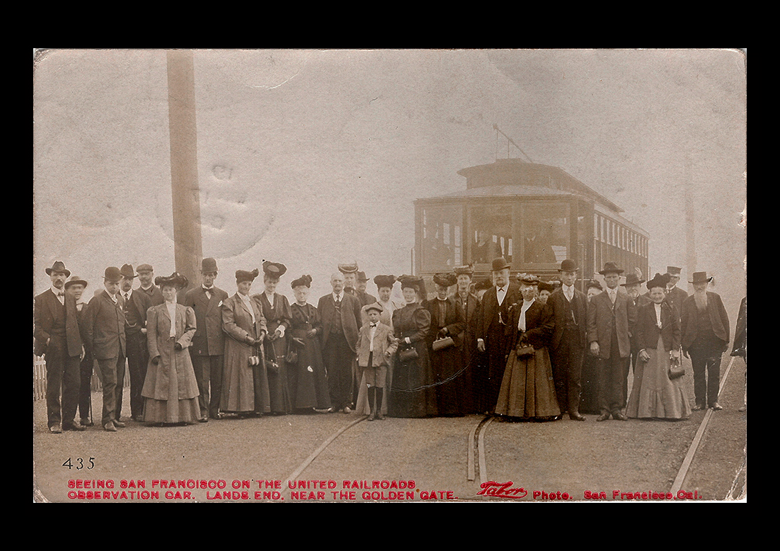
San Francisco in the years before the 1906 fire provided a sort of Big Rock Candy Mountain for the entire American people. . .
|
||
|
||
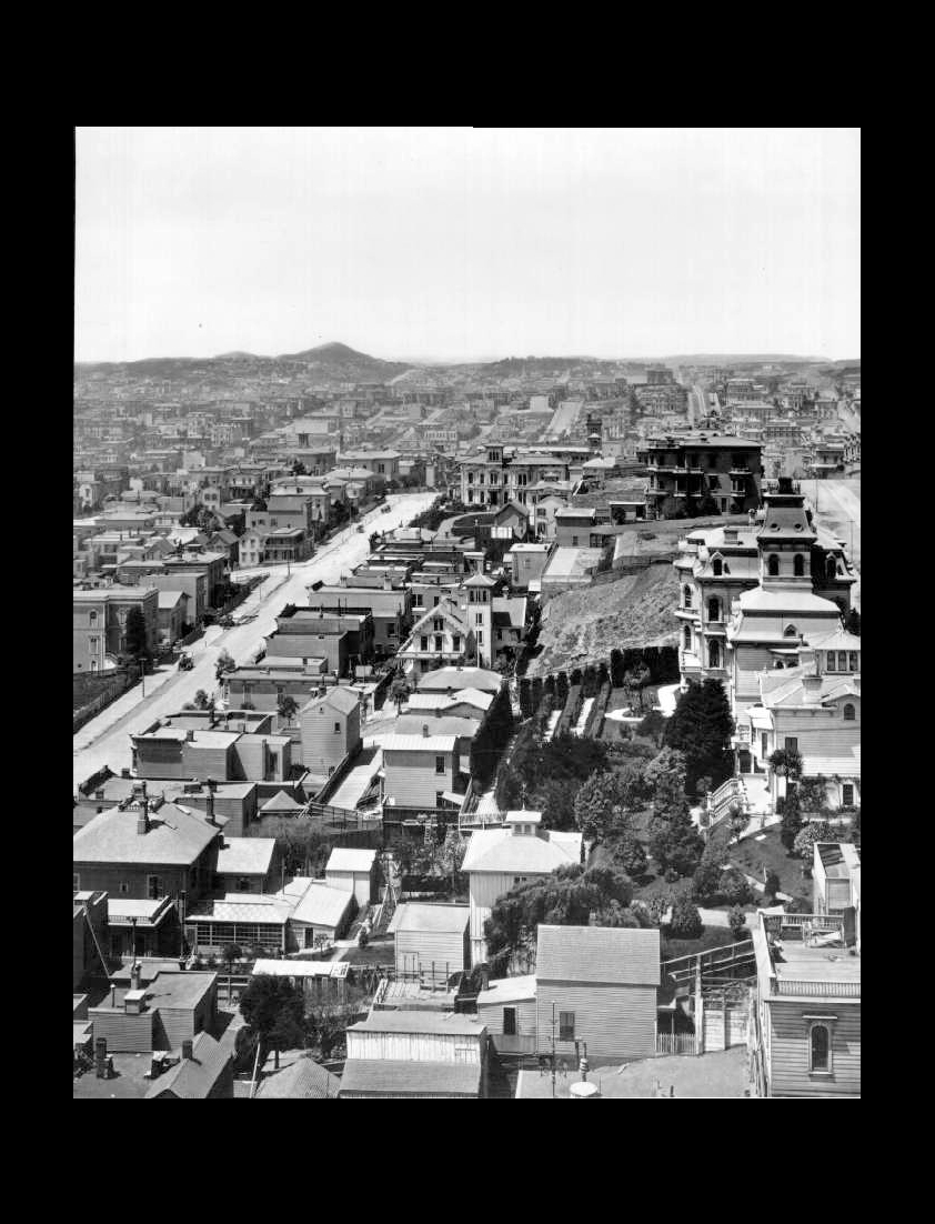
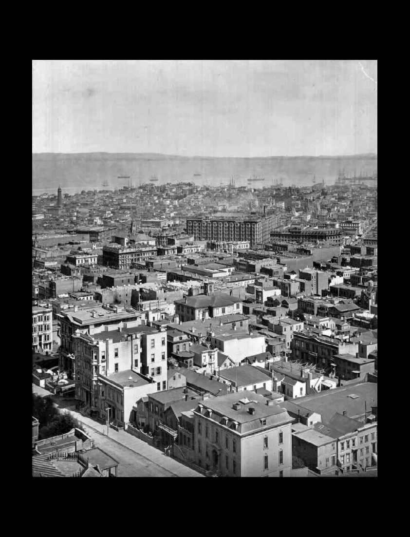
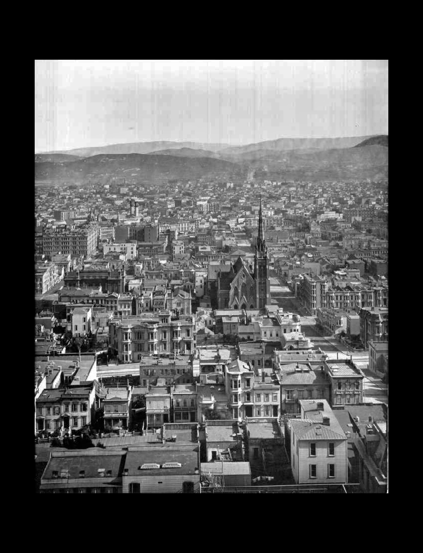
The photo is a portion of the San Francisco panorama that was shot by Eadweard Muybridge in 1878. The terraced garden near the center of the photo is the backyard of Richard Tobin's home on Mason and California. The bump on the horizon is Lone Mountain.View the entire panorama here: 1878 PanoramaA 17-foot-long printed copy of this 1878 panorama can be viewed in the front lobby of the San Francisco Historical Society Museum at 608 Commercial. The large panorama is also on display inside Masonic Auditorium on Nob Hill. |
||
 |
||
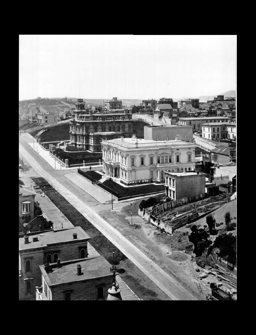
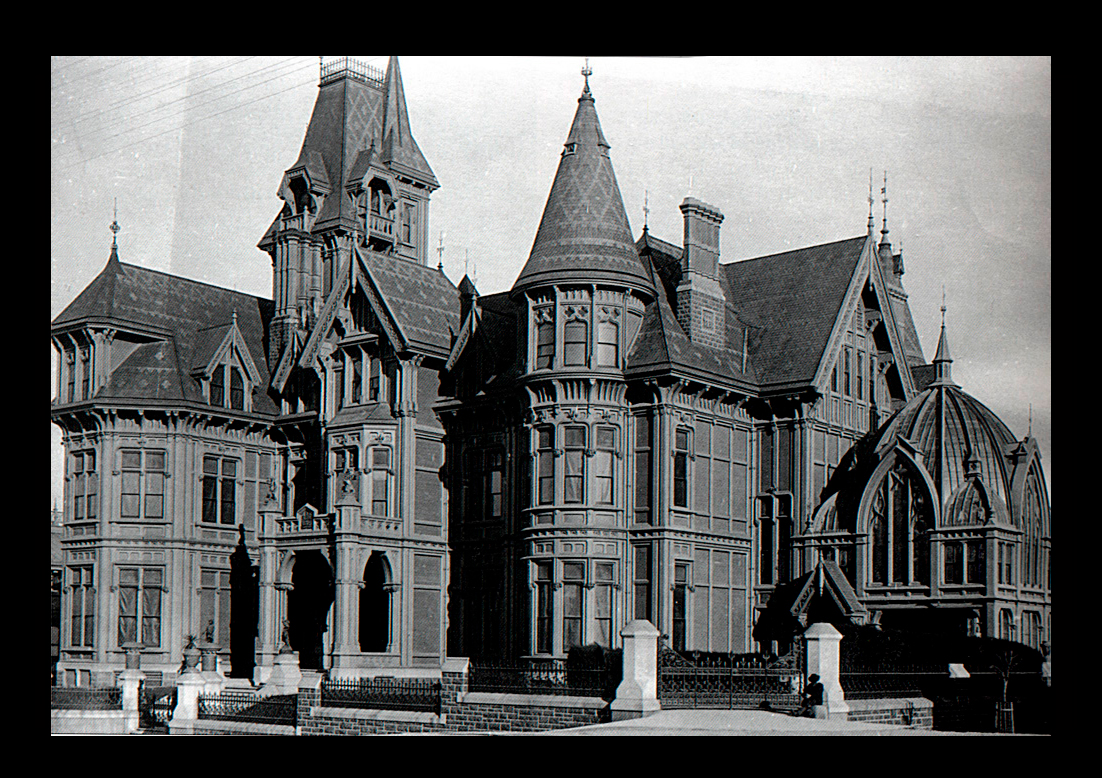
Nob Hill, circa 1889From Mason Street, looking west up California Street. Charles Crocker's home is the dark mansion. It took up the whole block on Nob Hill where Grace Cathedral is now located. Collis Huntington's mansion is in the center of this photo. It stood at the site of today's Huntington Park on Nob Hill.Both mansions burned in April 1906.
|
||
|
||
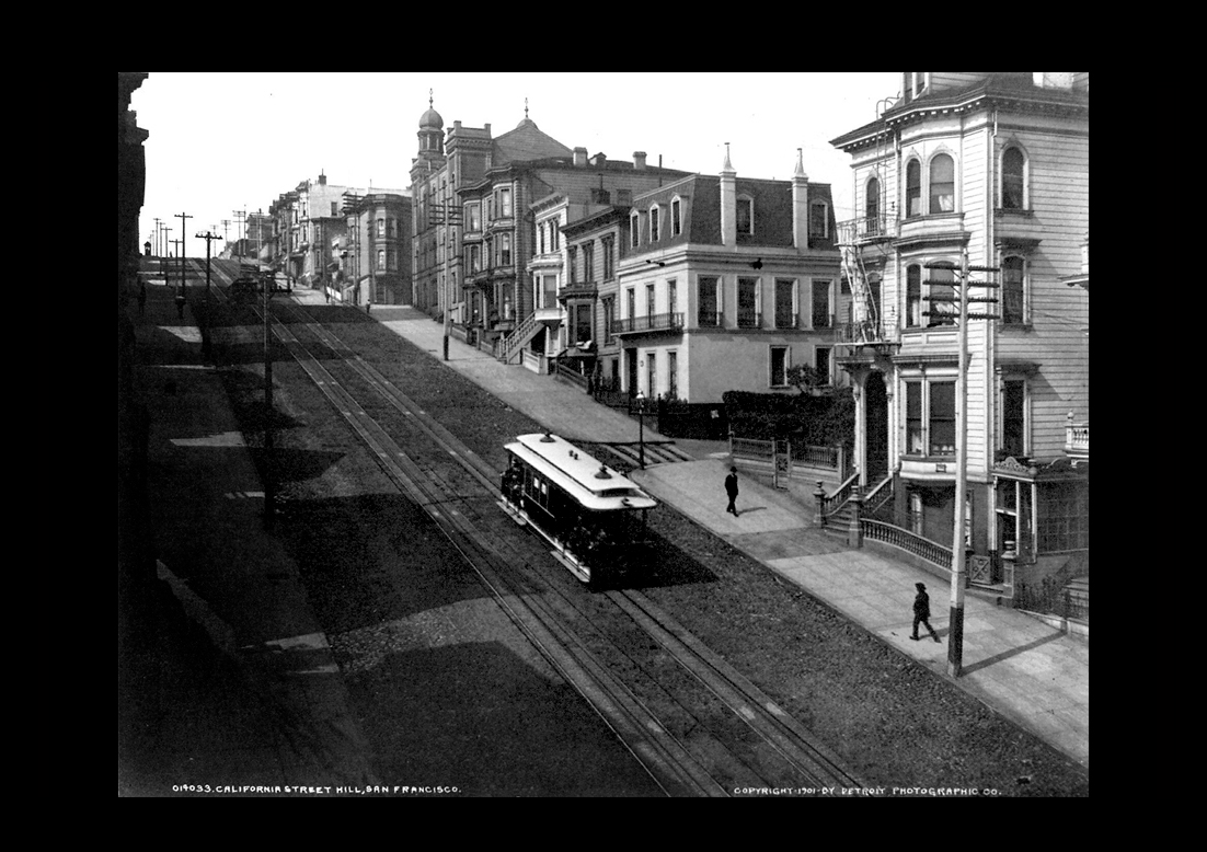
California Street Hill in 1901 |
||
|
||
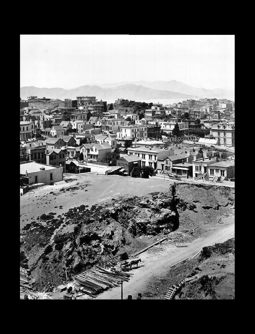
The photo is a portion of the San Francisco panorama that was shot by Eadweard Muybridge in 1878.The vacant lot is where the silver baron James Flood will build a mansion that burns in 1906. The 1906 burned-out shell of the mansion eventually becomes the Pacific Union Club. The dirt road in the bottom right of the image is today's Mason Street and the front entrance to the Fairmont Hotel.View the entire Muybridge panorama here: 1878 PanoramaA 17-foot-long printed copy of this 1878 panorama can be viewed in the front lobby of the San Francisco Historical Society Museum at 608 Commercial. The large panorama is also on display inside Masonic Auditorium on Nob Hill. |
||
|
||
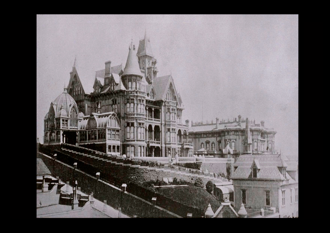
The rear of the Mark Hopkins mansion viewed from down around Pine Street. Circa 1890’sThe Hopkins mansion stood on Nob Hill at California and Mason where the Intercontinental Mark Hopkins Hotel is located today. The mansion cost 3 and a half million dollars in 1878, about 95 million in today's money. |
||
|
||
California Street (at Montgomery) looking west to Nob Hill circa. 1870-80s |
||
|
||
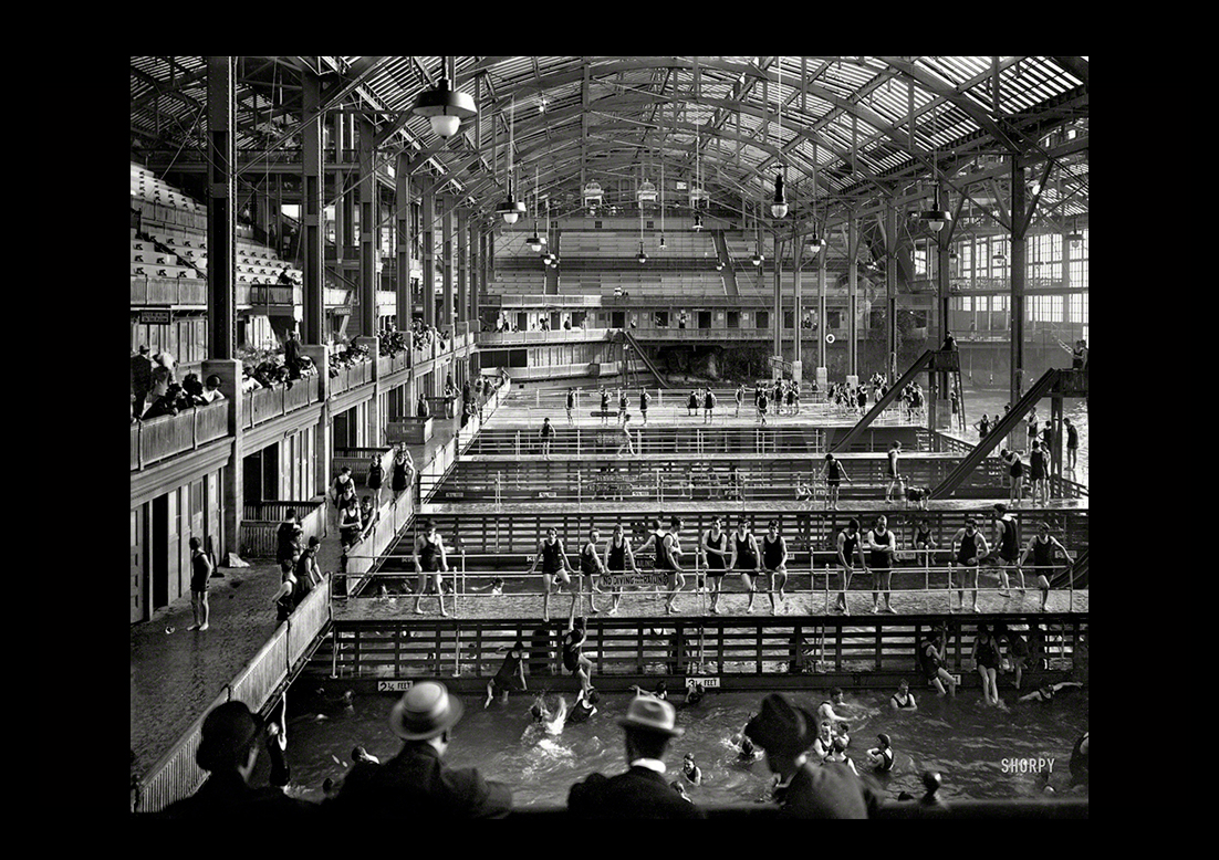
San Francisco's Sutro Baths ca. 1896Coastal conditions inhospitable to swimming inspired San Francisco's former mayor Adolf Sutro to open an immense indoor pool in a sheltered inlet adjacent to the Cliff House, which he also owned and operated. Sutro Baths opened in 1896 and survived the earthquake and fire in 1906. It finally closed in 1966 and later burned to the ground while it was in the process of being demolished. The ruins of the Sutro Baths near the Cliff House and Seal Rocks is now part of the Golden Gate National Recreation Area. |
||
|
||
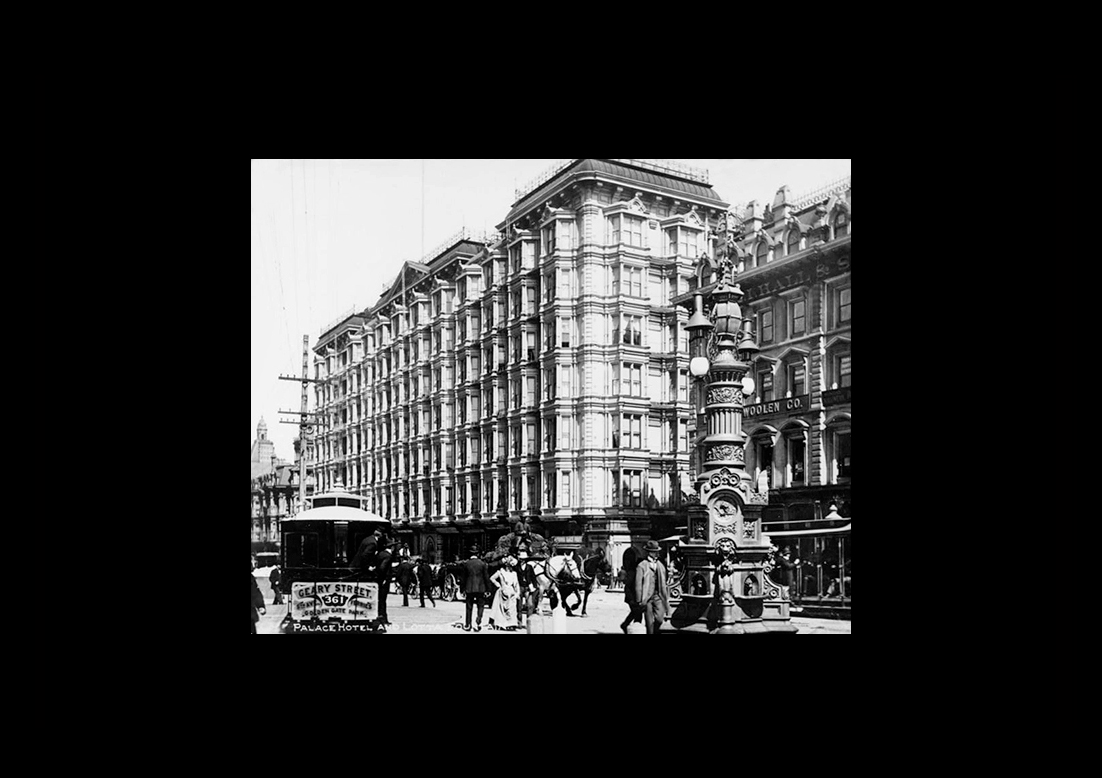
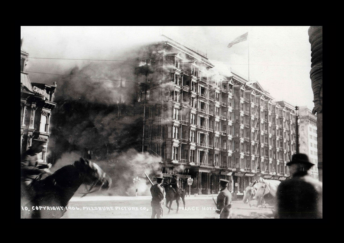
The night before the 1906 earthquake, renowned Italian tenor Enrico Caruso performed in San Francisco. The world-famous opera singer escaped the city’s Palace Hotel, where he was staying at the time of the quake; however, the hotel itself was destroyed later that day by fire. |
||
 |
||
California at Grant Avenue near the edge of the frame on the right. The building in the left corner is the Stanford Stables (now the University Club). On the left side of the photo near the middle is the Hall of Justice, the Montgomery Block, and the Customs House. Almost everything in this photo burned in 1906.The photo is a portion of the San Francisco panorama that was shot by Eadweard Muybridge in 1878.View the entire Muybridge panorama here: 1878 PanoramaA 17-foot-long printed copy of this 1878 panorama can be viewed in the front lobby of the San Francisco Historical Society Museum at 608 Commercial. The large panorama is also on display inside Masonic Auditorium on Nob Hill. |
||
|
||
|
||
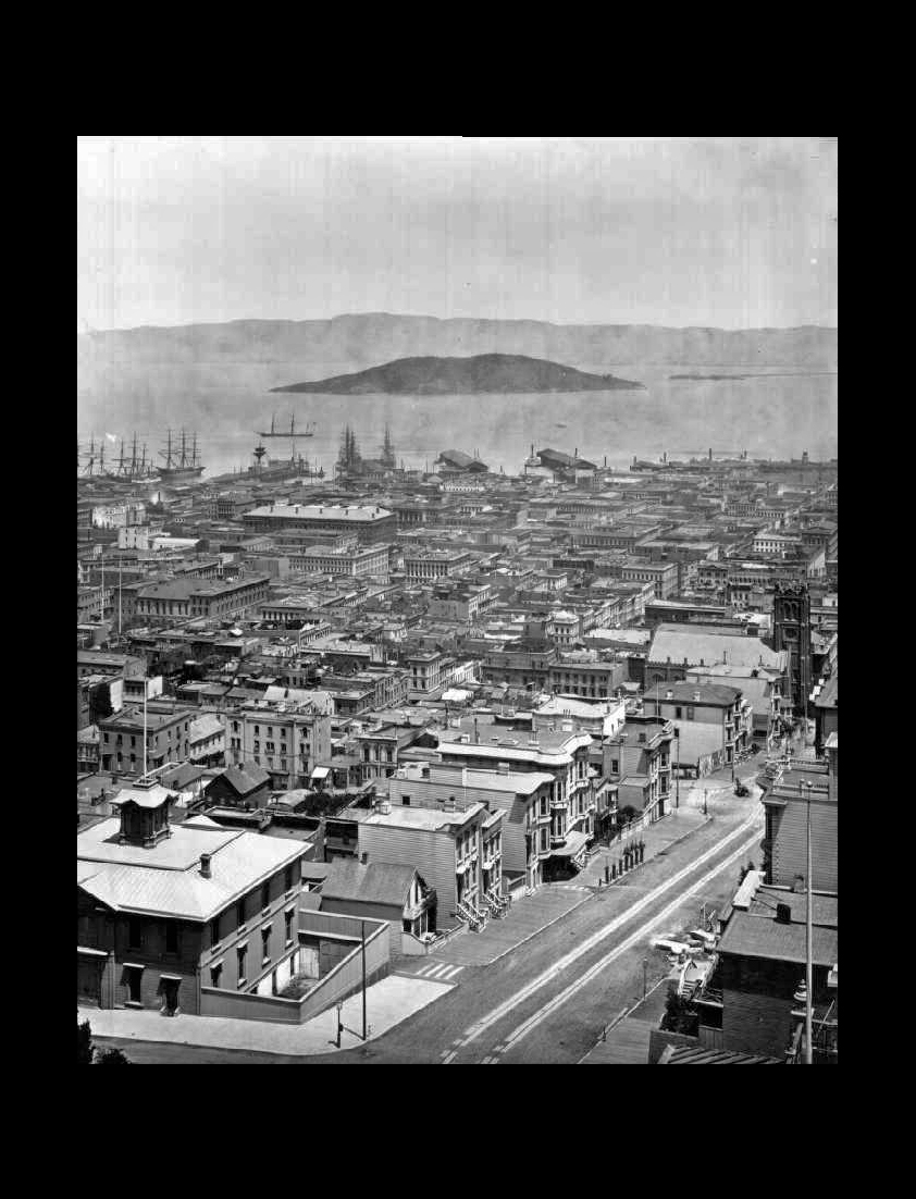
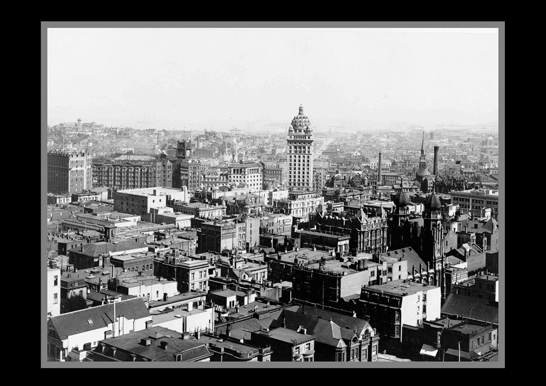
The photo is a portion of the San Francisco panorama that was shot by Eadweard Muybridge in 1878. In the center of the photo is the Palace Hotel. Near the left edge is the Selby Shot Tower, near the site of today's Salesforce Tower.View the entire Muybridge panorama here: 1878 PanoramaA 17-foot-long printed copy of this 1878 panorama can be viewed in the front lobby of the San Francisco Historical Society Museum at 608 Commercial. The large panorama is also on display inside Masonic Auditorium on Nob Hill. |
||
|
||
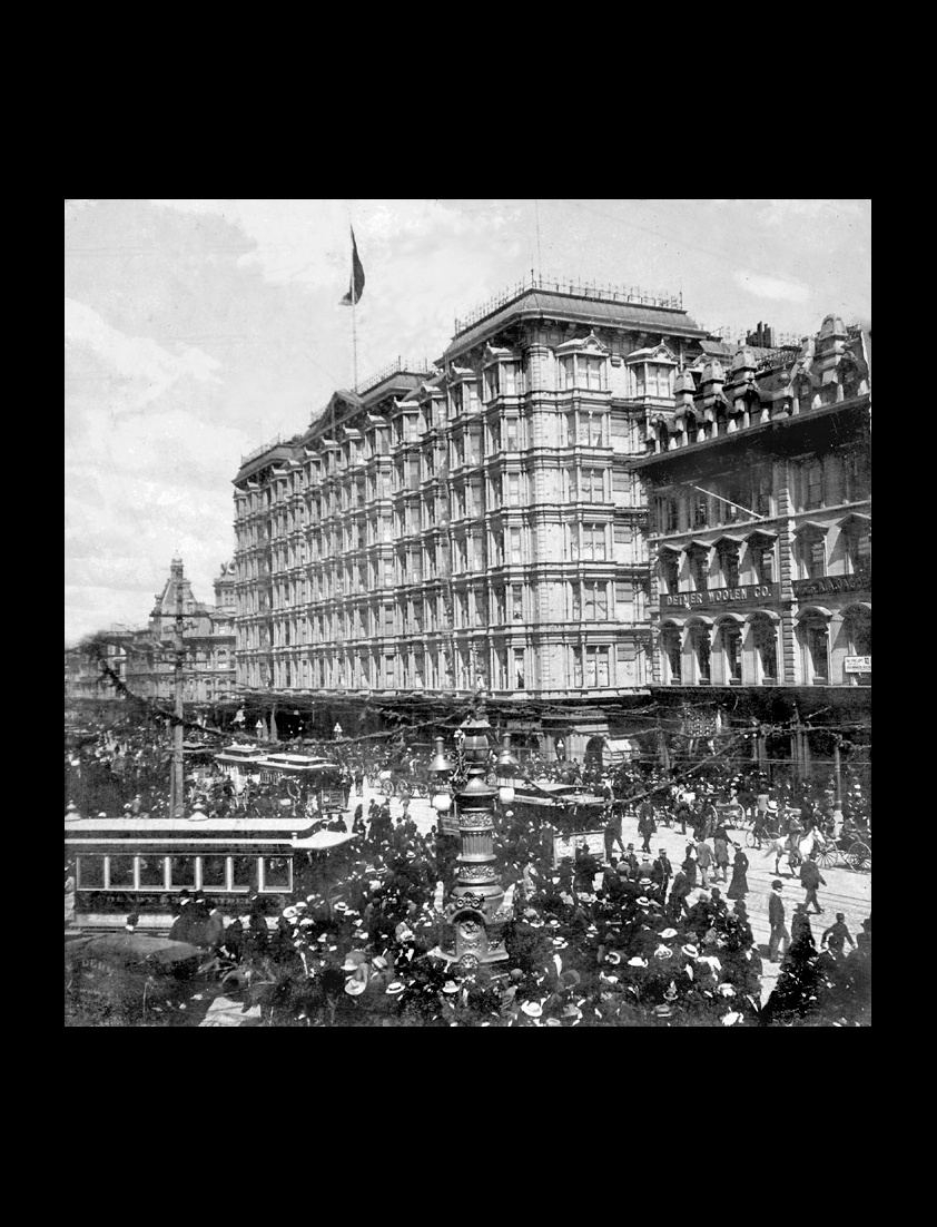
The Palace Hotel cost $7 million to create and sat on two-and-a-half acres. When it opened in 1875, the Palace Hotel was the largest hotel in the country and it boasted a bar tended by 30 men. It was appointed with linen, marble, wood and china from all over the world. It was equipped with state-of-the-art water and safety systems, and had a seven-story atrium for guests to drive their carriages into. The Palace hosted such prestigious visitors as Ulysses Grant, Rudyard Kipling, and Emperor Dom Pedro III of Brazil. |
||
|
||
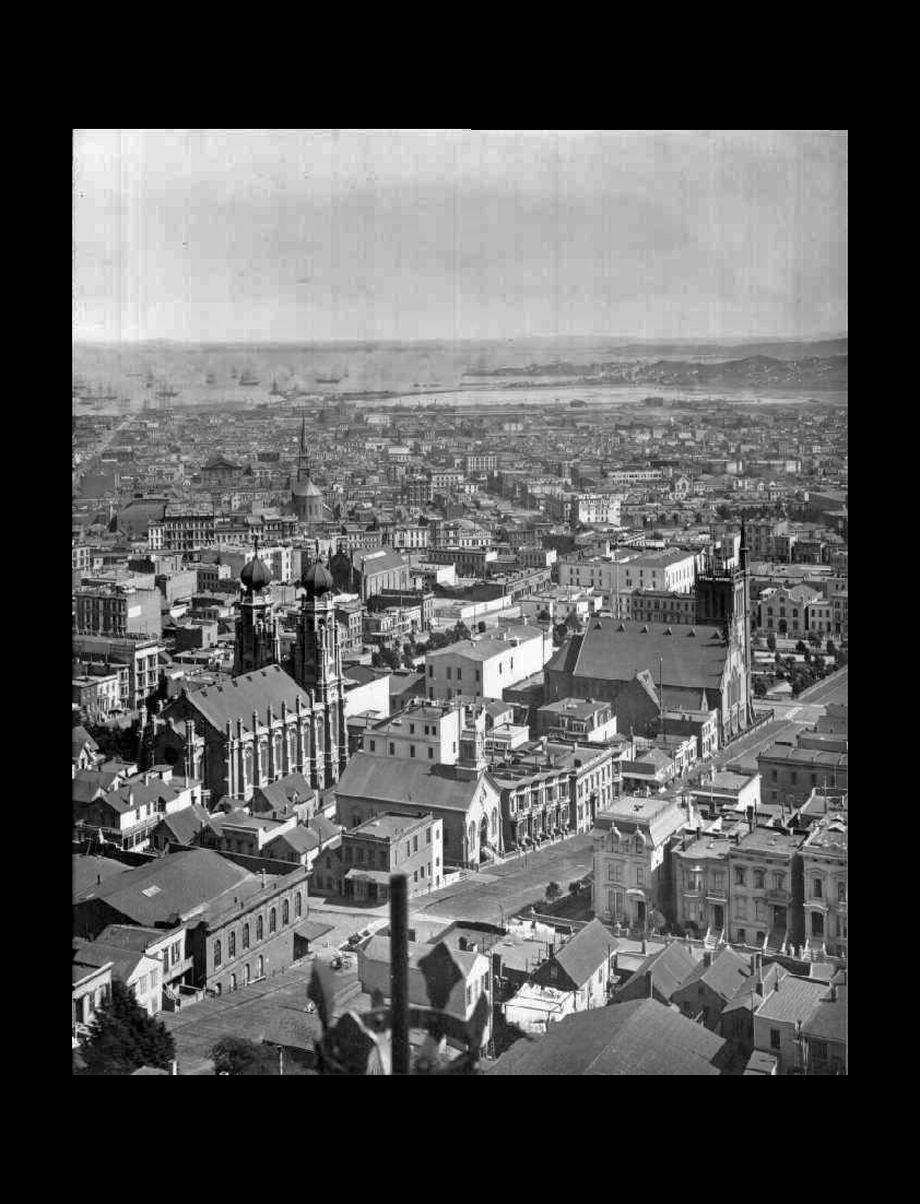
The photo is a portion of the San Francisco panorama that was shot by Eadweard Muybridge in 1878. Seen is St. Patrick's on Mission Street in the distance on the left, and the Temple Emanuel with two onion-domed towers, also on the left.View the entire panorama and learn more about it here: 1878 PanoramaA 17-foot-long printed copy of this 1878 panorama can be viewed in the front lobby of the San Francisco Historical Society Museum at 608 Commercial. The large panorama is also on display inside Masonic Auditorium on Nob Hill. |
||
|
||
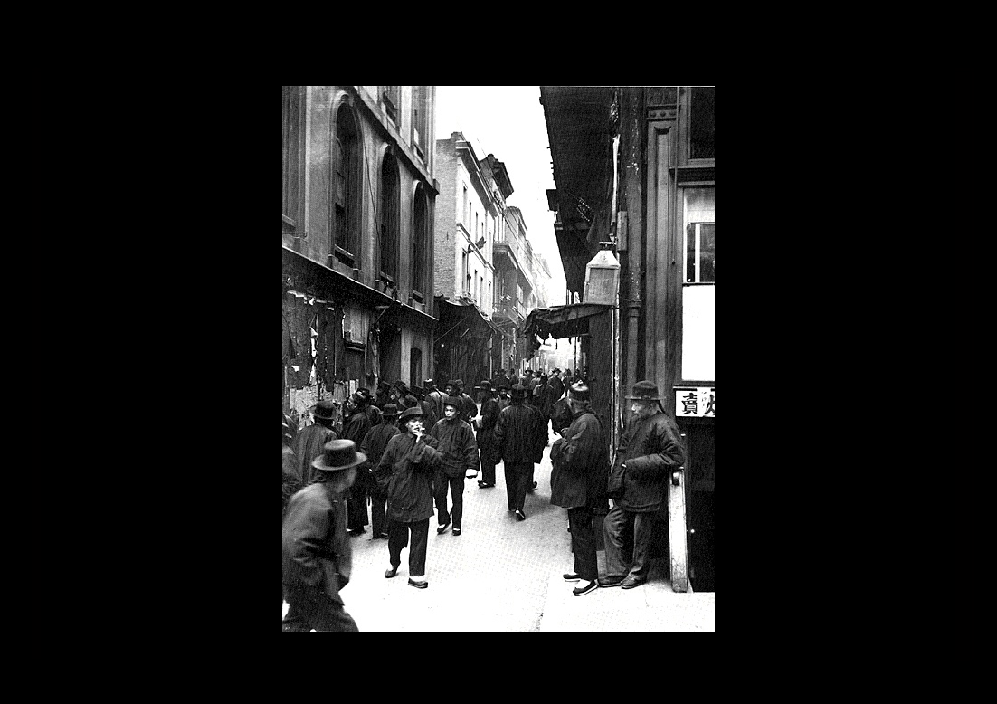
San Francisco's Chinatown before the earthquake and fire. |
||
|
||
The photo is a portion of the San Francisco panorama that was shot by Eadweard Muybridge in 1878. View the entire Muybridge panorama here: 1878 PanoramaA 17-foot-long printed copy of this 1878 panorama can be viewed in the front lobby of the San Francisco Historical Society Museum at 608 Commercial. The large panorama is also on display inside Masonic Auditorium on Nob Hill. |
||
|
||
|
||
The Mark Hopkins mansion on Nob Hil. The home had 70 rooms and cost three million dollars when it was built in 1878.It burned on April 19th, the second day of the fire.After the firestorm, very little remained of this structure that had been filled with countless treasures. Built by Mark Hopkins, it was located on Nob Hill near the Stanford, Huntington, Flood and Crocker mansions. In 1906, it was the Mark Hopkins Art Institute and was owned by the University of California. |
||
 |
||
On April 18, 1906, at precisely 5:13 a.m., local time, a foreshock occurred with sufficient force to be felt widely throughout the San Francisco Bay area. The great earthquake broke loose some 20 to 25 seconds later, with an epicenter near San Francisco. Violent shocks punctuated the strong shaking which lasted some 45 to 60 seconds ... The earthquake and subsequent fires devastated San Francisco, California, leaving more than 3,000 people dead and destroying more than 28,000 buildings. The quake ruptured the San Andreas fault to the north and south of the city, for a total of 296 miles, and could be felt from southern Oregon to Los Angeles and inland to central Nevada. |
||
|
||
|
||
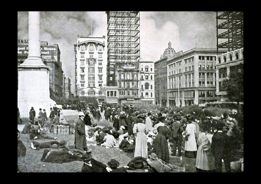
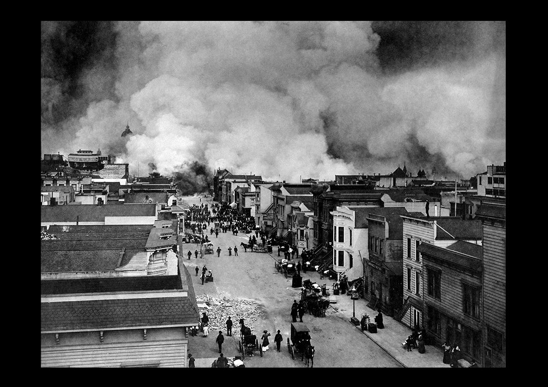
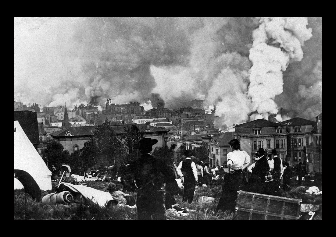
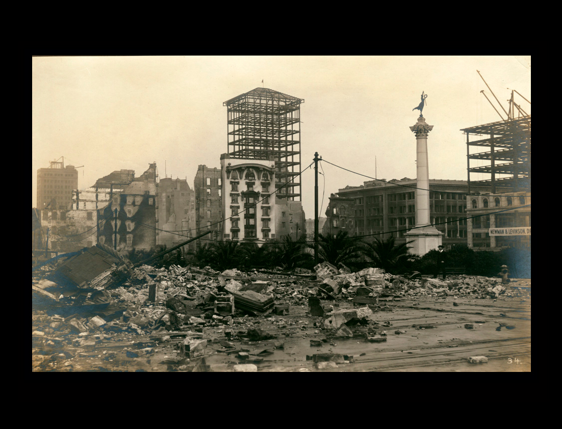
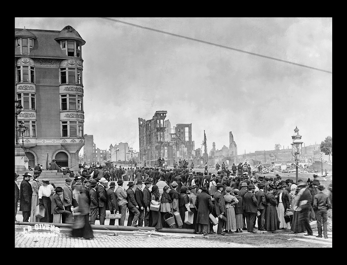
People fleeing from the flames are resting in Union Square.All the buildings shown here eventually burned. |
||
|
||
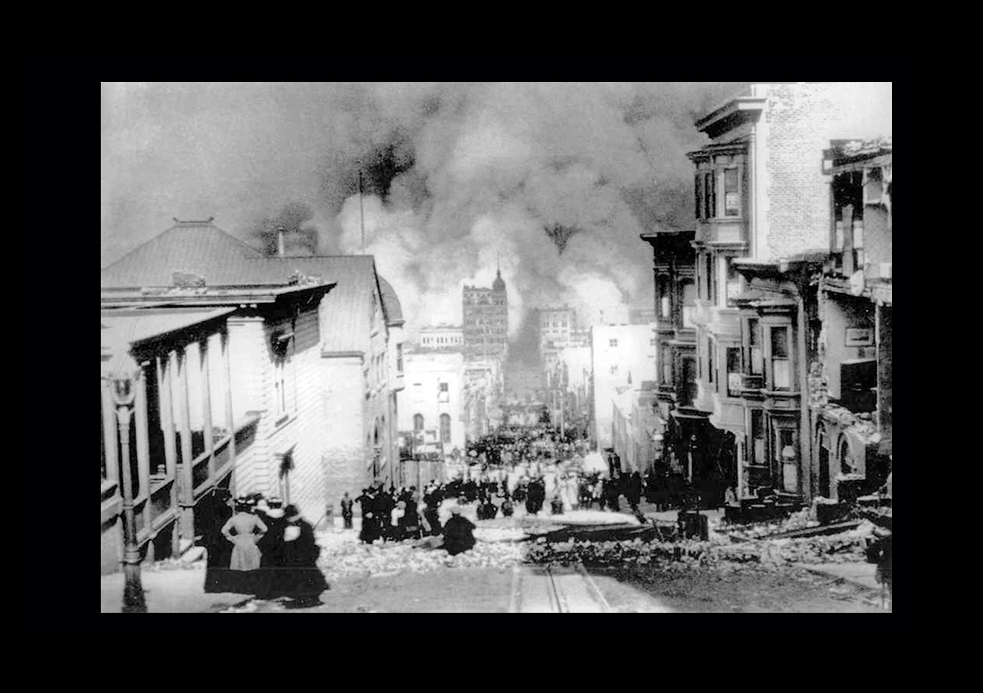
This photograph by Arnold Genthe shows Sacramento Street and approaching the fire. |
||
|
||
The greatest devastation resulted from the fires that quickly followed the quake. The initial tremors destroyed the city’s water mains, leaving firefighters with no means of combating the growing blaze, which burned for several days and consumed much of the city. |
||
|
||
Hayes Valley and the 'Ham and Eggs Fire'.After the quake, in Hayes Valley, a woman lit up her stove to prepare breakfast. But what she did not know was that the chimney (above her stove) was badly damaged. This started the 24-hour long ‘Ham and Eggs’ fire, which destroyed parts of City Hall and Market Street. The site of the original spark in Hayes Valley is stated as 395 Hayes Street. |
||
|
||
The Palace Hotel on Market StreetThis beautiful hotel, known by travelers the world over was built in the 70s, by James Ralston at a cost of $1,000,000 and was owned by the Sharon estate. It was the home of many wealthy families and the loss in art treasures was great. |
||
|
||
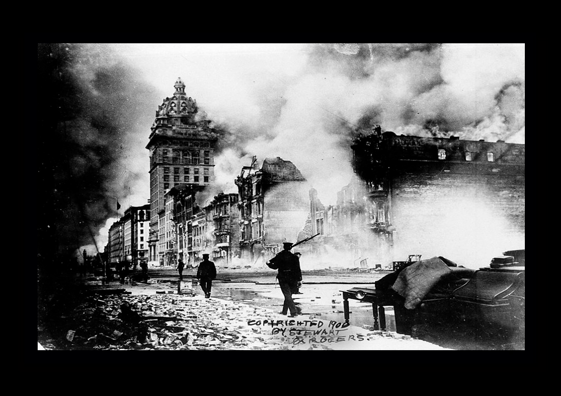
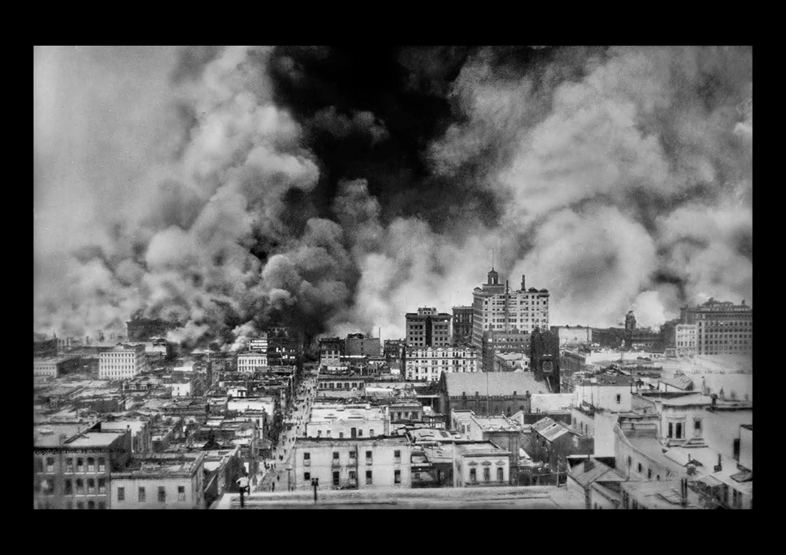
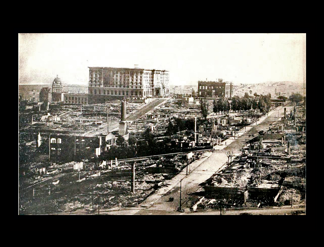
The Call Building, the most conspicuous structure in the city, was seventeen stories |
||
|
||
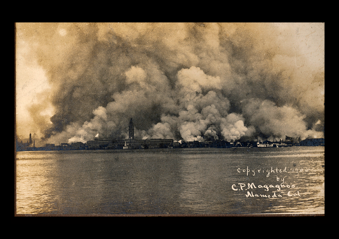
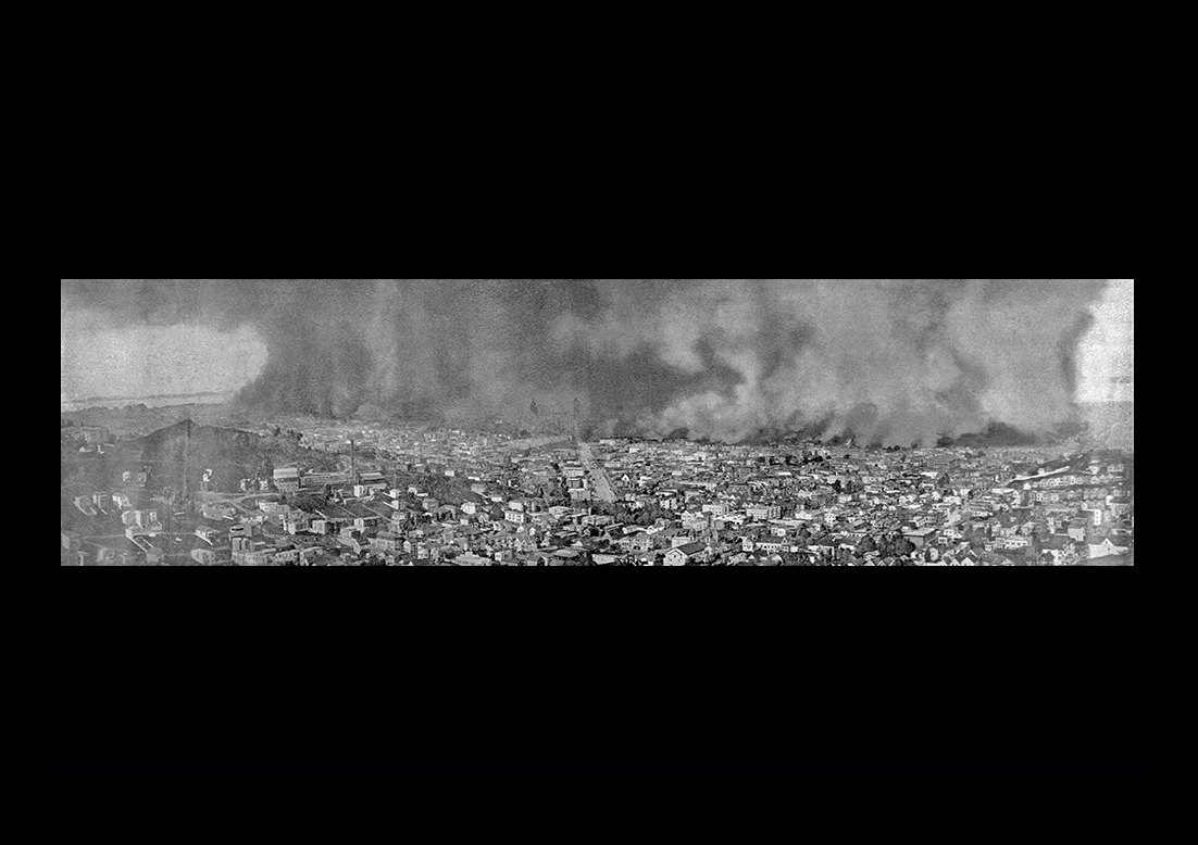
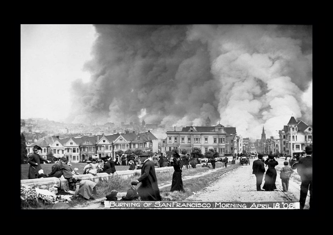
The view of San Francisco burning as seen from Alamo Square in the Western Addition |
||
|
||
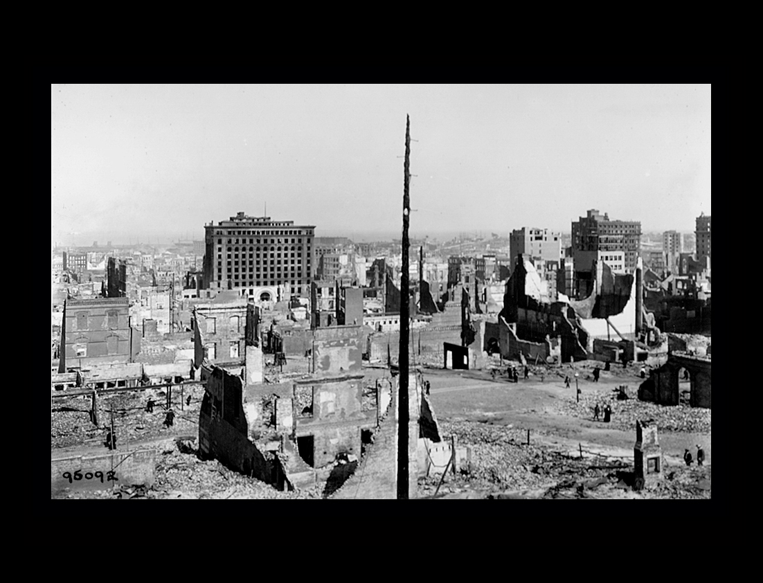
The downtown district was practically wiped off of the map. In many localities everything had been fused and melted in a whirlwind of fire while in other places only one or two stories
|
||
 |
||
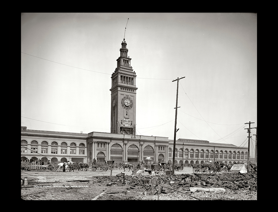
The Ferry Building on San Francisco's Embarcadero was the gateway of escape for thousands of refugees on their way out of the burning city. The refugees in their fight brought many a strange burden. One man wheeled a barrow with one shoe in it. Others carried canary birds and empty cages and one dragged a lawn mower after him over the bricks and stones and debris. The clock on the face of the 230ft. high tower stopped with the hands pointing to 5.13am, the moment earthquake struck.The Ferry Building, built of structural iron faced with sand stone, in 1906 was a terminus for public transportation lines in the city that made it one of the busiest places on the West Coast.In 1989 during the Loma Preita earthquake, the flagpole on top of the Ferry Building's tower was knocked askew at a dangerous angle. |
||
|
||
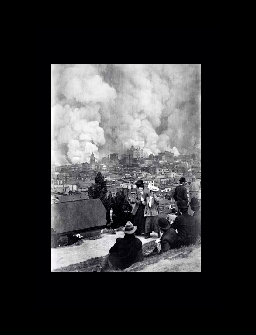
Smoke and ash from the firestorm in San Francisco rose six miles into the athmosphere. At night, the glow from the fire burning in San Francisco could be seen in Palo Alto 36 miles away. |
||
|
||
|
||
San Francisco in 1906 had a population of approximately 400,000 people. |
||
|
||
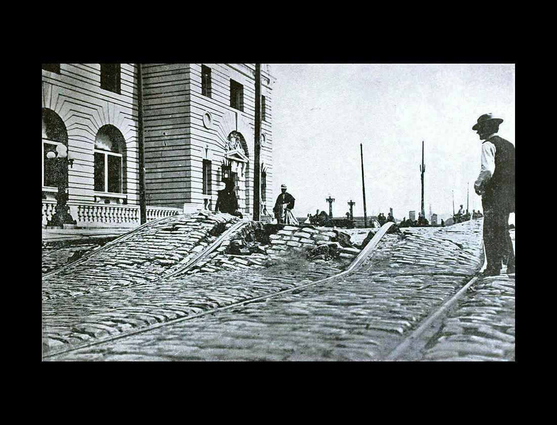
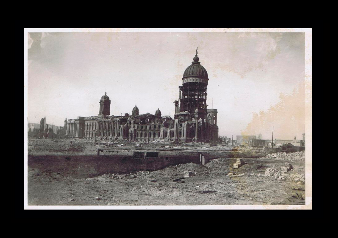
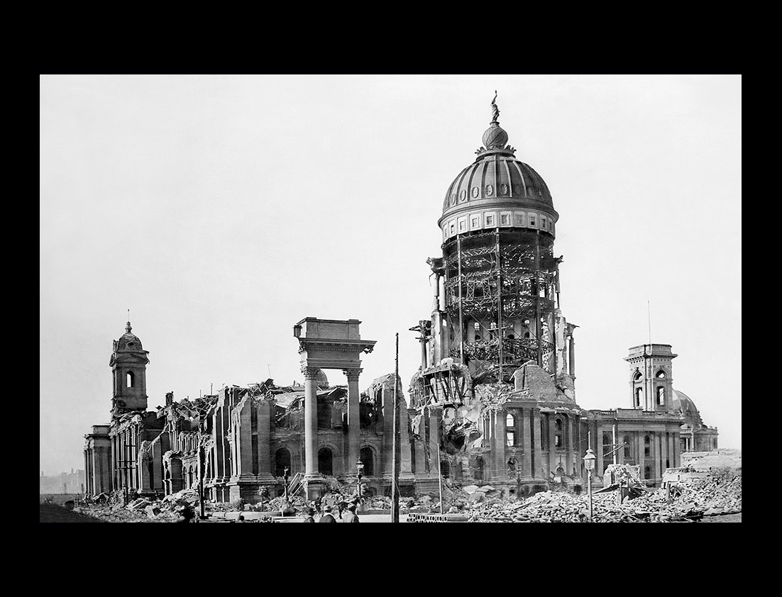
A view of the San Francisco City Hall showing the skeleton steel work of the immense tower stripped of its masonry, the dome still standing intact. Among the debris can be seen many curiosity seekers. |
||
|
||
The ruins of San Francisco seen from the tower of the Ferry BuildingIn 1906, reliable insurance inspectors who examined the field of ruin and devastation claimed that a greater part of the city could have been saved, had it not been for the death of the veteran Fire Chief Sullivan early on the first day of the catastrophe. The department was left without a head at the very crisis of its career. |
||
|
||
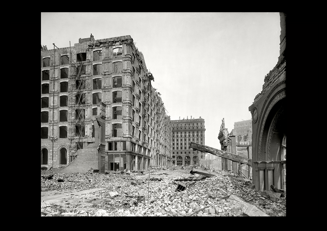
Shorpy image of "Palace Hotel, New Montgomery Street." San Francisco in the aftermath of the earthquake and fire of April 18, 1906. 8x10 glass negative.View full size. |
||
|
||
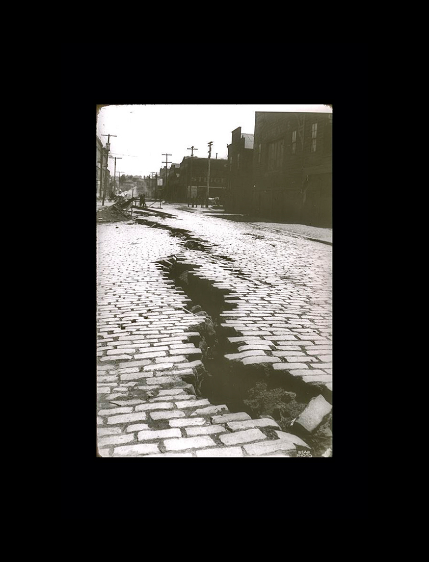
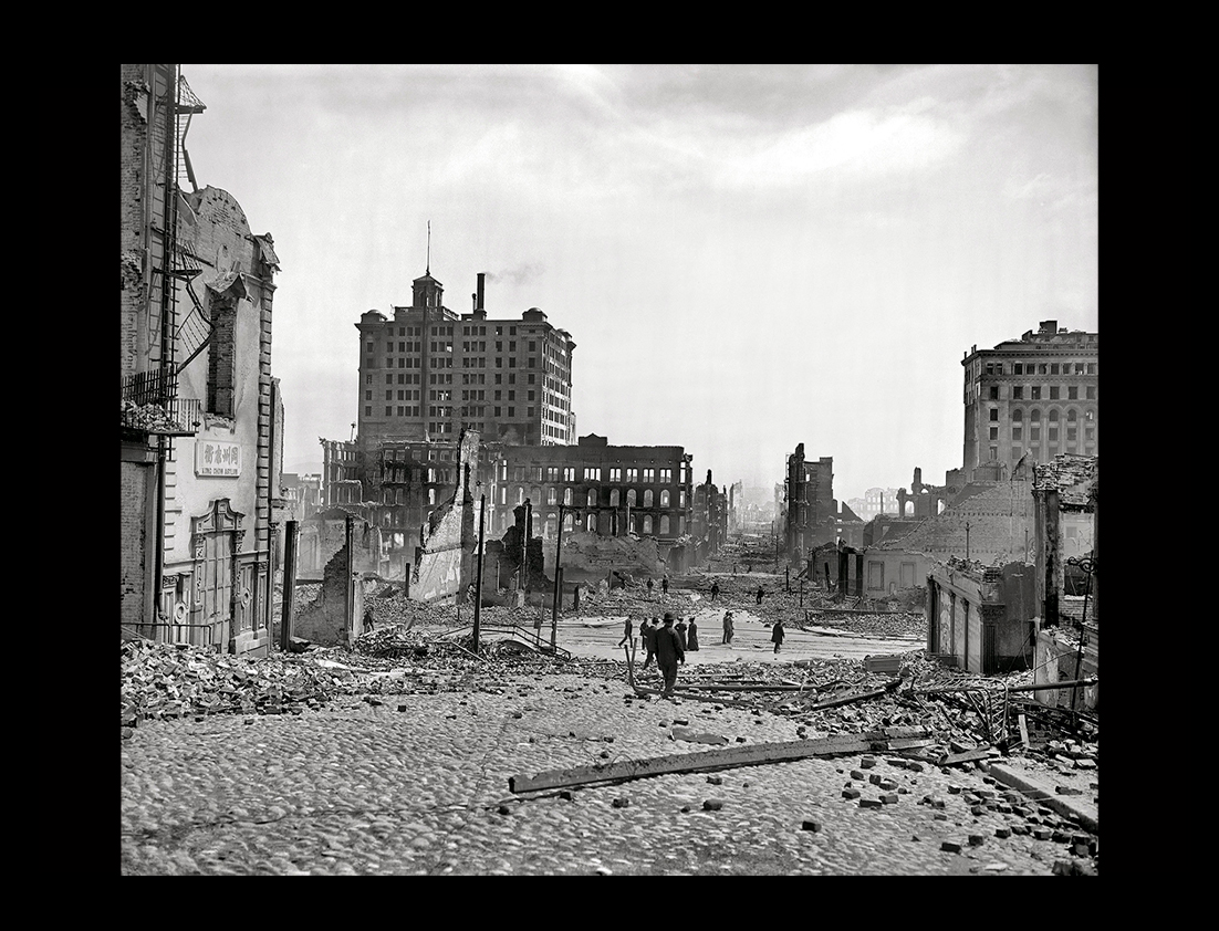
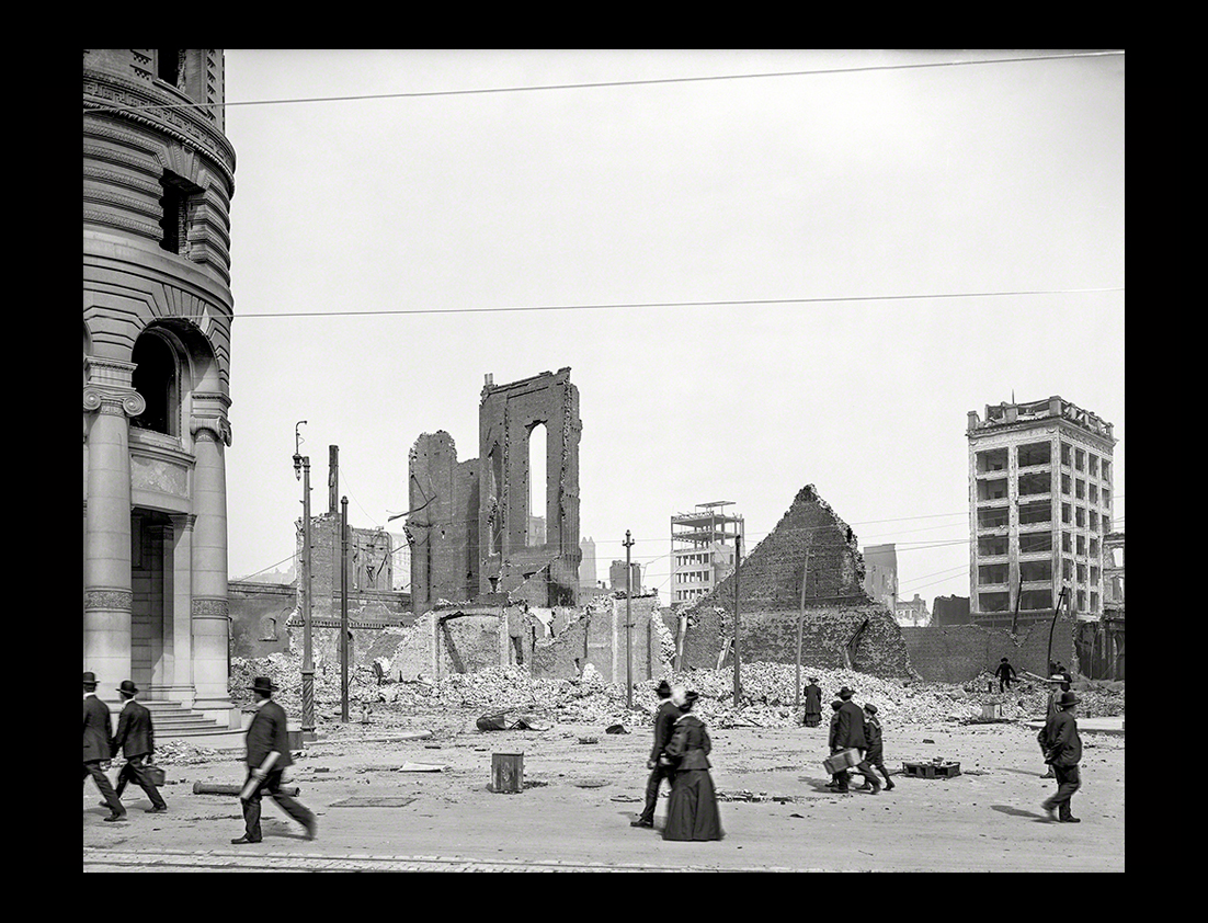
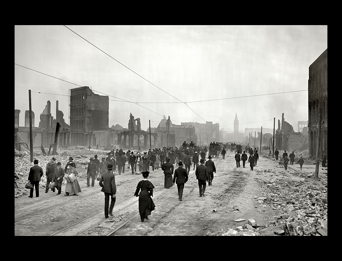
Shorpy image of San Francisco after the earthquake and fire of April 1906. "Turk Street, from the corner of Market and Mason." Detroit Publishing Company.View full size.Many of the San Francisco structures were twisted into inconceivable shapes, while others flattened down and still others were almost crushed to powder. |
||
|
||
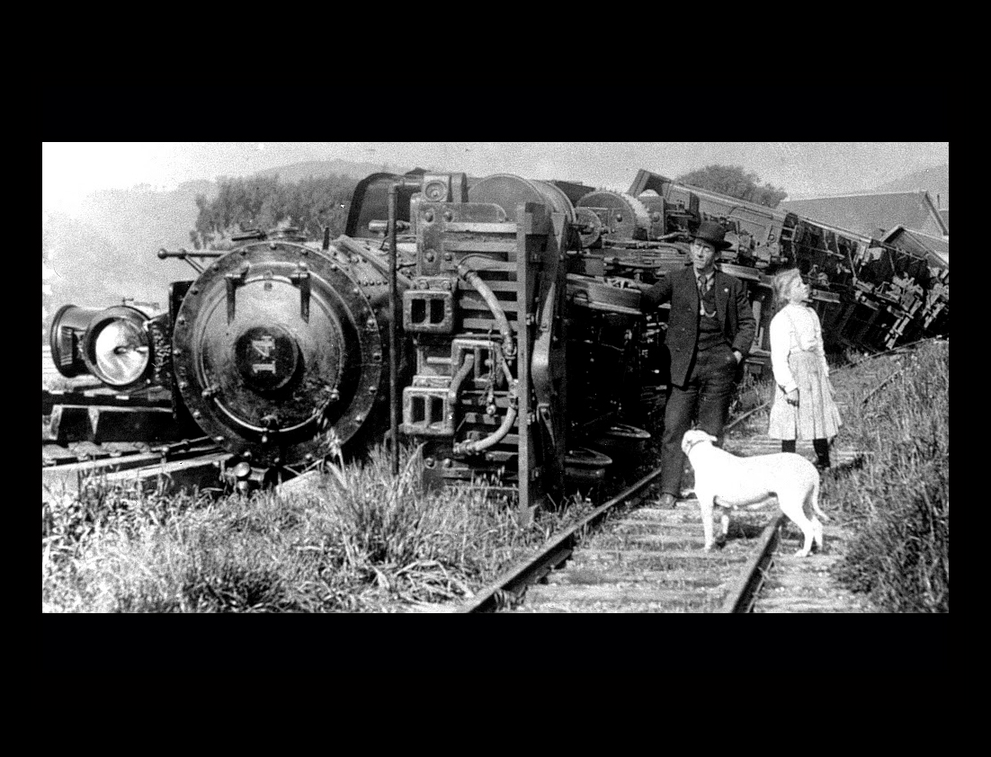
Point Reyes, north of San Francisco, on April 18, 1906. |
||
|
||
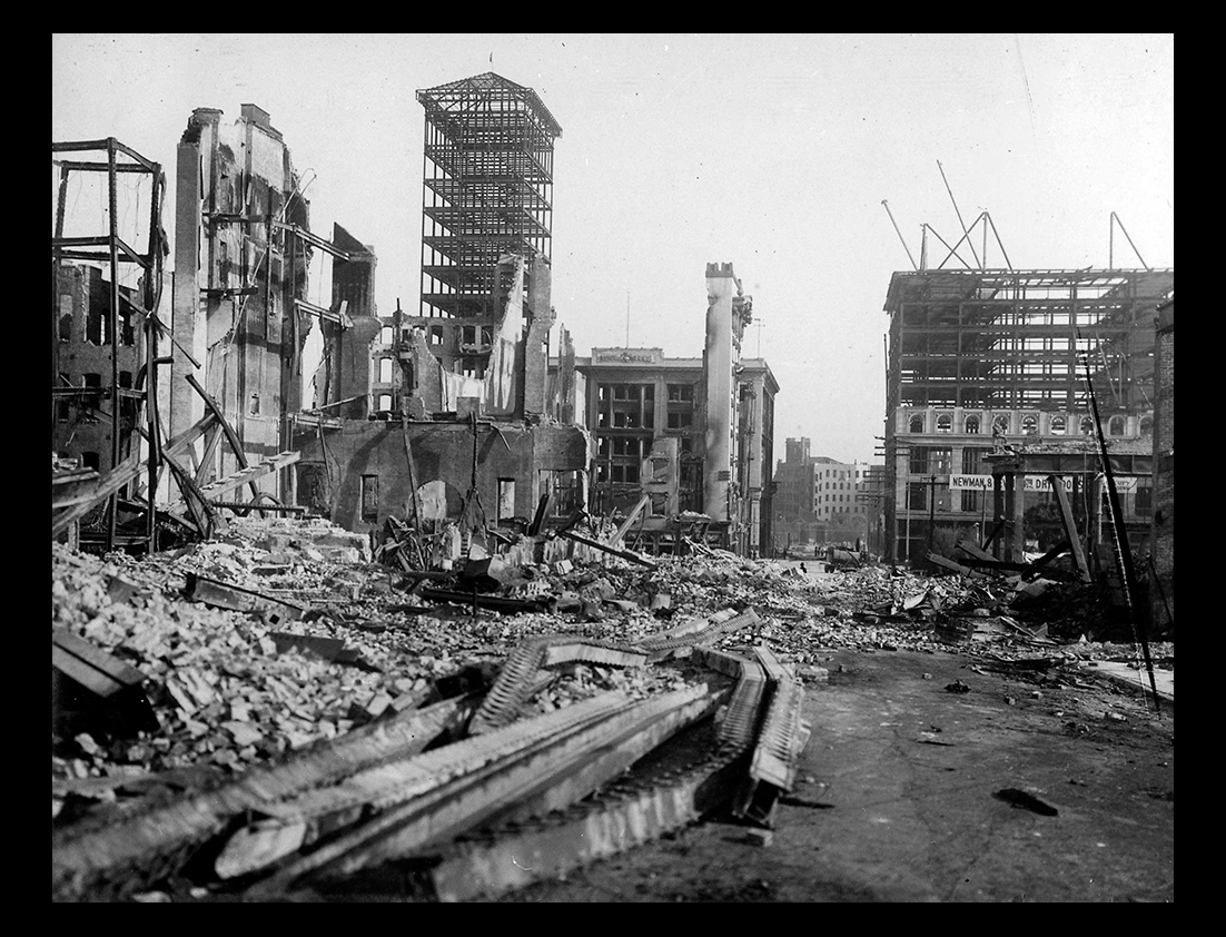
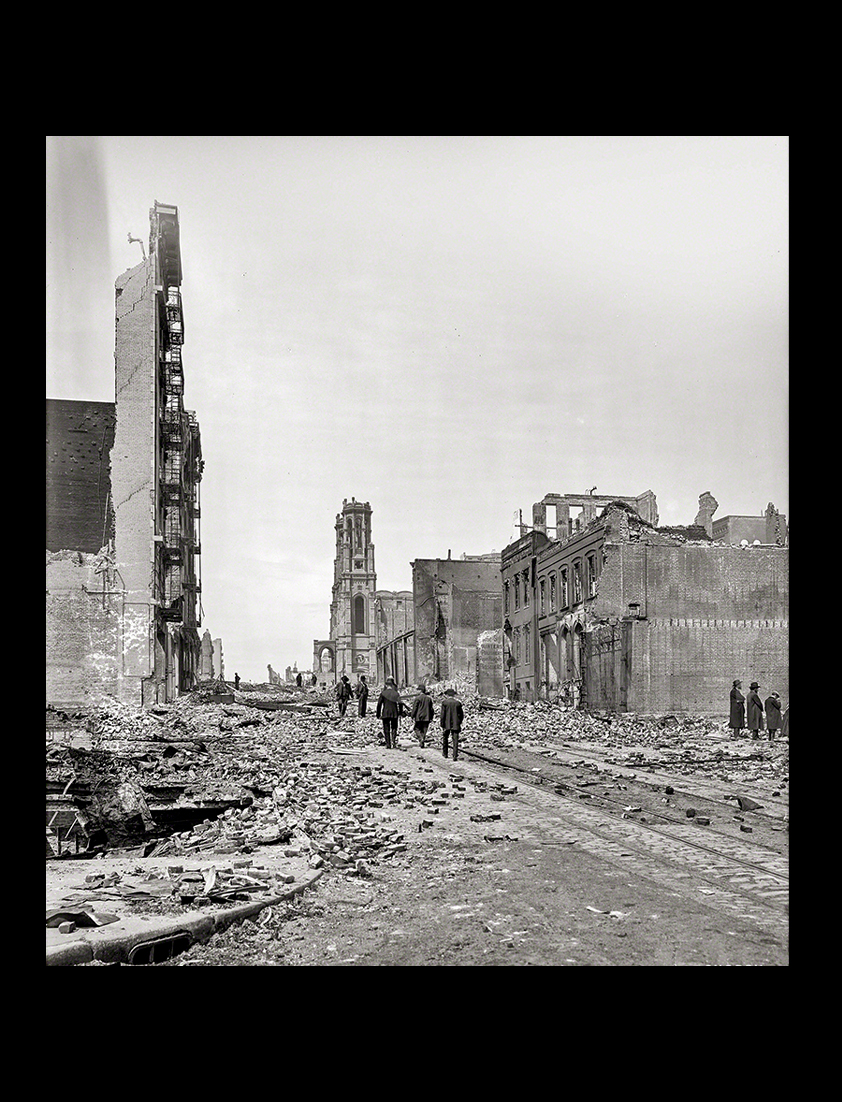
Ruined apartment buildings, private residences, together with the ramshackle tenements and skid-row flop houses south of Market, were licked up in the scorching blast of fire and flame. |
||
 |
||
Not only was the earthquake one of the worst catastrophes in US history, it was the first major natural disaster that had its effects recorded photographically. |
||
|
||
Ruins of Fairmont Hotel with the Flood mansion on the right, located on Nob Hill, with acres of debris shown in foreground. In the distance are the waters of San Francisco Bay. The streets became almost impassable, and the bodies of the dead lay where they had fallen, covered by debris and fallen walls, and millions of dollars worth of property disappeared like ice in the midday sun. |
||
|
||
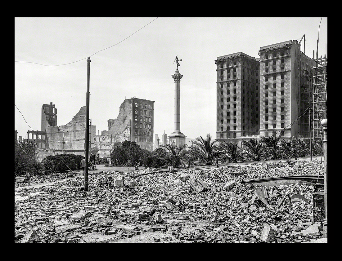
Union Square as viewed from the corner of Powell and Post Street |
||
|
||
Congress responded to the disaster in several ways. The House and the Senate Appropriations Committees enacted emergency appropriations for the city to pay for food, water, tents, blankets, and medical supplies in the weeks following the earthquake and fire. They also appropriated funds to reconstruct many of the public buildings that were damaged or destroyed. |
||
|
||
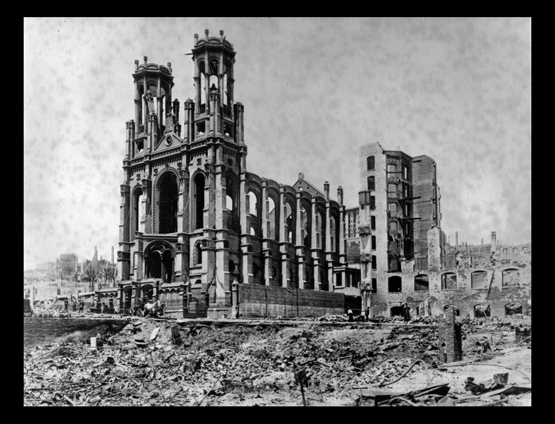
Ruins of the Temple Emanuel at 450 Sutter Street in San Francisco |
||
|
||
A general view of San Francisco after the earthquake and fire. The city is located on a peninsula, separated from the mainland by San Francisco Bay, one of the finest harbors in the world. This bay connects with the Pacific Ocean by the famous Golden Gate Strait. The original name of the city was Yerba Buena, Spanish for "good herb", but it was changed to its present name, which is Spanish for Saint Francis in 1847. |
||
|
||
|
||
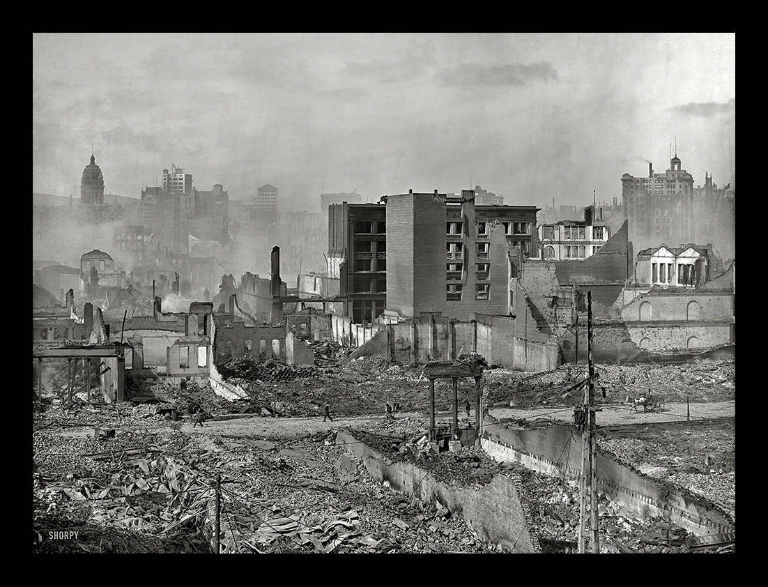
Shorpy image of "Panorama from roof of Ferry P.O., San Francisco." Aftermath of the April 1906 earthquake and fire. 8x10 glass negative, Detroit Publishing Co.View full size.Brick and stone and steel, symbols of strength, during the earthquake in 1906, became as brittle as glass, as pliable as lead and as soft and yielding as sand. Pavements crumbled and crunched like sugar, brick chimneys and walls fell like so much powder while steel and iron skyscrapers collapsed like kindling wood. |
||
|
||
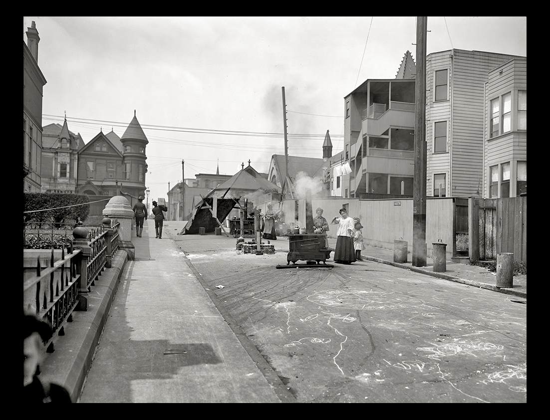
Shorpy image of San Francisco, April 1906, after the earthquake and fire that leveled much of the city. "Cooking in the street." Detroit Publishing glass negative.View full size. |
||
|
||
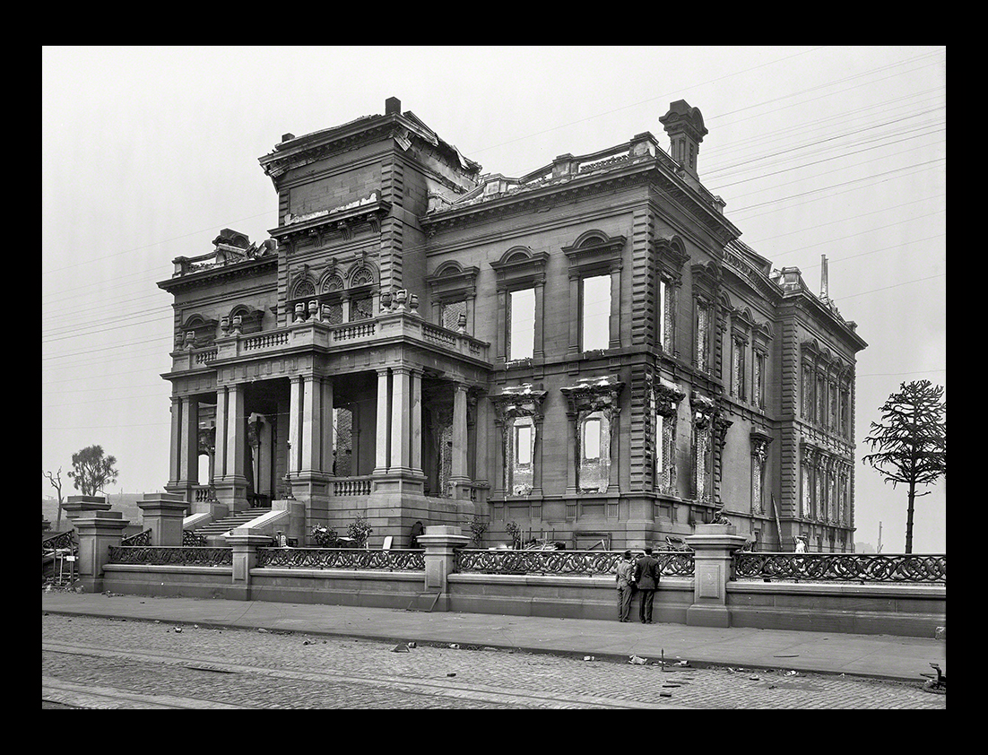
Shorpy image of "The Flood Mansion, Nob Hill." After the 1906 San Francisco earthquake and fire. 8x10 dry plate glass negative.View full size. |
||
 |
||
San Francisco's Union Square as viewed from Stockton and Post Street |
||
|
||
Shorpy image of "Van Ness Avenue -- limit of fire, San Francisco." Aftermath of the devastating earthquake of April 1906. 8x10 inch glass negative.View full size.In 1906, Van Ness Avenue running north and south was one of the widest streets in the world, 141 feet with 22 foot side walks. As the raging fire was burning downtown San Francisco, Van Ness seemed to be the only ray of hope of those living west of this avenue as its extreme width was believed sufficient to stop the fire even if all other means failed. |
||
|
||
Looking west on Sutter Street (near Stockton?) with the distant ruins of the Temple Emanuel at 450 Sutter. |
||
|
||
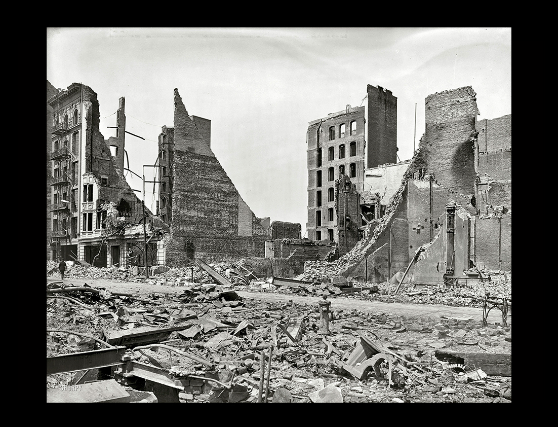
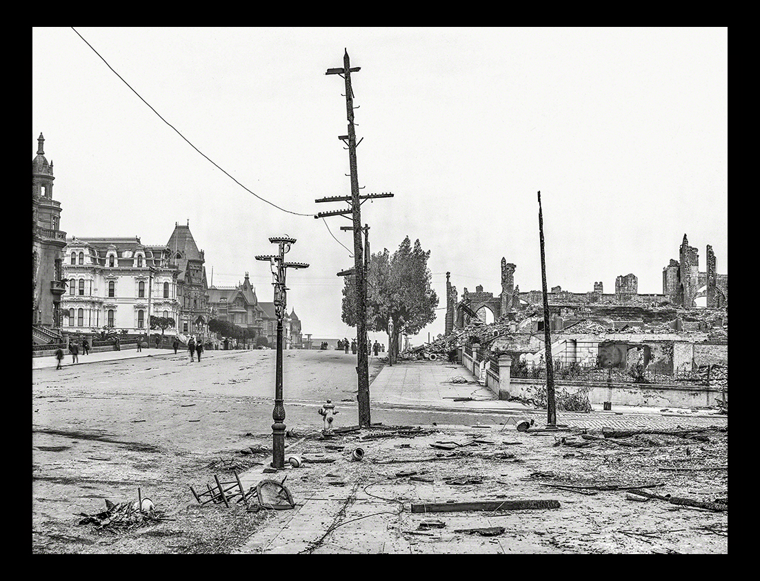
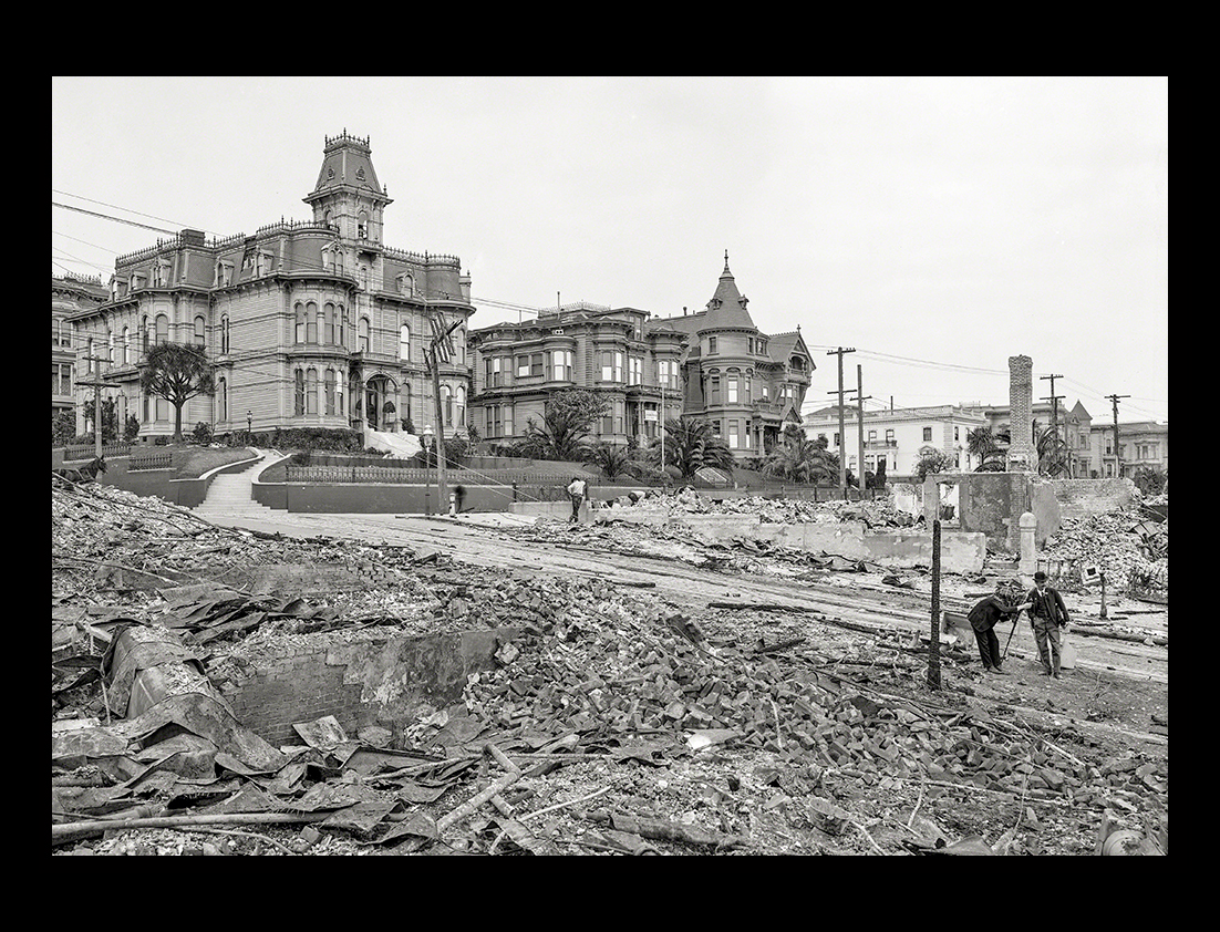
Shorpy image of "Edge of burned district, corner of Franklin and Sacramento Streets, San Francisco." Aftermath of the April 18, 1906, earthquake and fire. 8x10 inch dry plate glass negative, Detroit Publishing Company.View full size. |
||
|
||
|
||
|
||
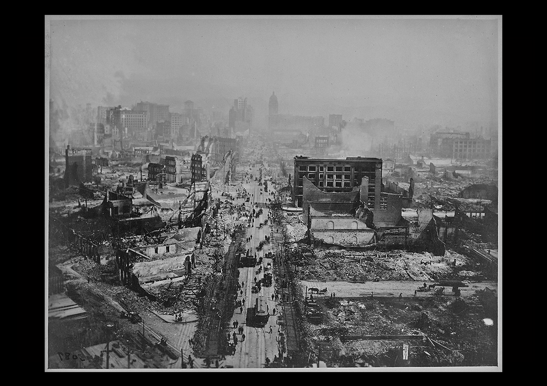
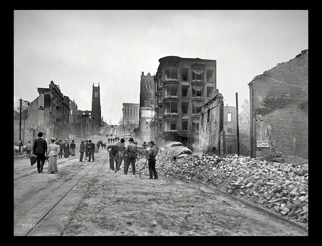
Shorpy image of "Market Street toward FerryBuilding." San Francisco after the earthquake and fire of April 18, 1906. 8x10 inch glass negative, Detroit Publishing Company.View full size."Every little helps. Throw a Brick."This is a sign that met the eye of every passer through this narrow outlet. Even one brick thrown aside from the passageway by each pedestrian would soon clear the street of its debris. Many of the vehicles using this road bore the mystic sign of the red cross which gave the right of way over all other conveyances. |
||
|
||
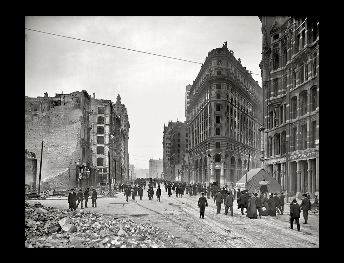
Shorpy image of San Francisco in the aftermath of the earthquake and fire of April 18, 1906. "Up Market Street from Montgomery Street." 8x10 glass negative.View full size. |
||
|
||
Shorpy image of San Francisco, April 1906, after the earthquake and fire that leveled much of the city. "Cooking in the street." Detroit Publishing glass negative.View full size. |
||
|
||
Shorpy image of "Ferry Building, San Francisco, 1906." Aftermath of the earthquake and fire. 8x10 inch dry plate glass negative, Detroit Publishing Company.View full size. |
||
 |
||
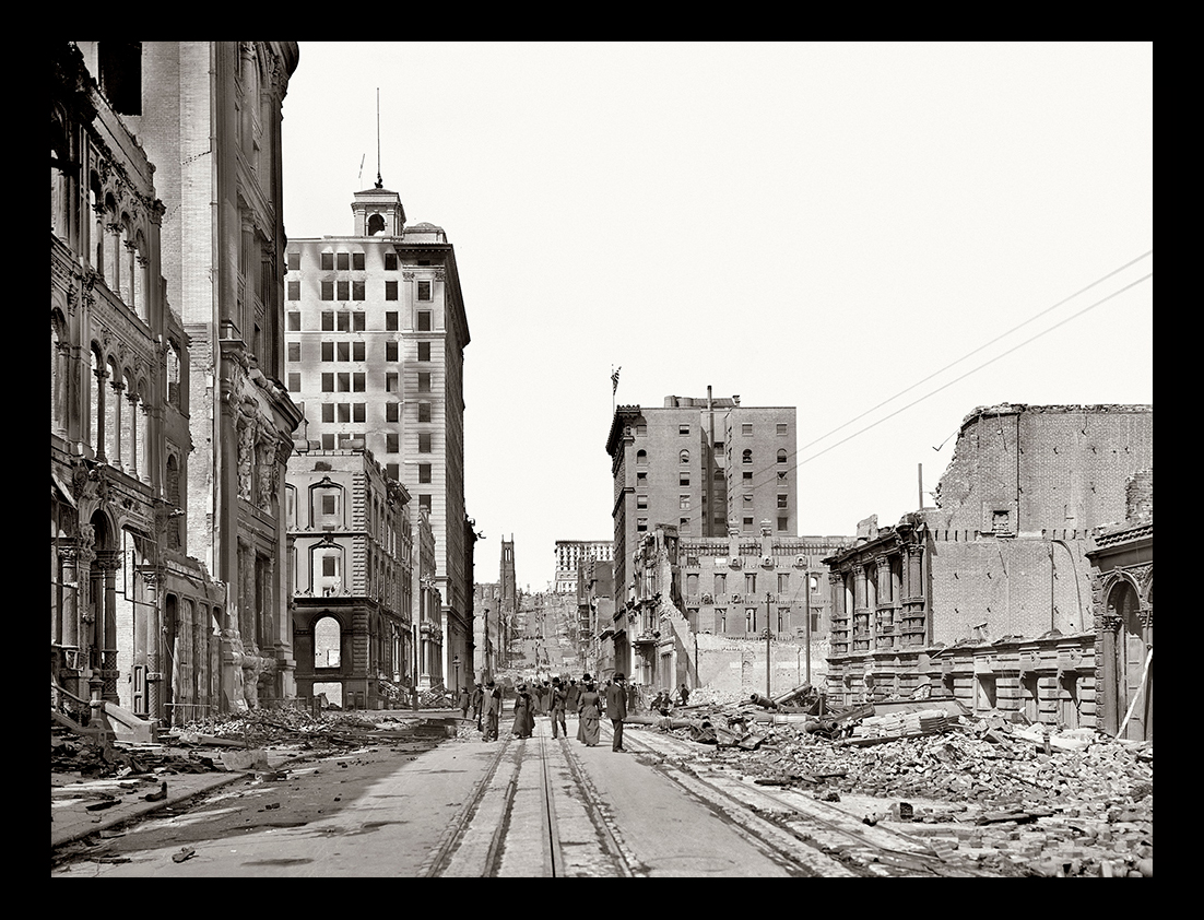
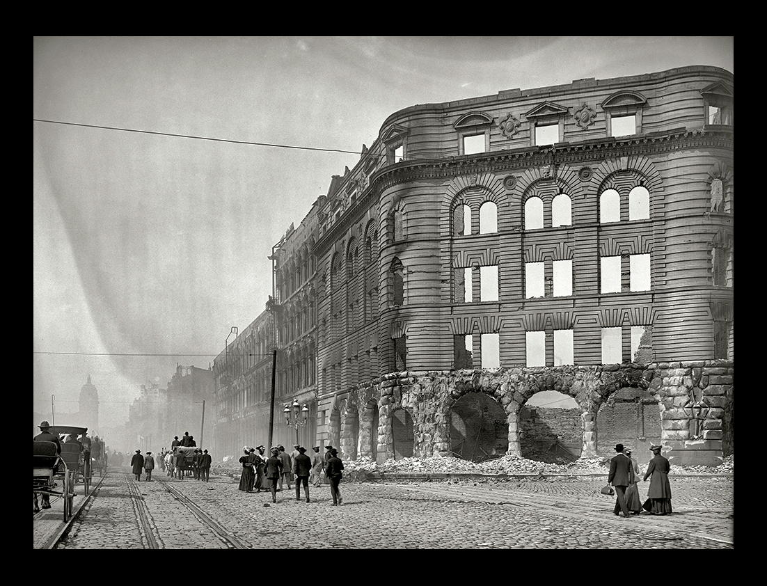
Shorpy image of San Francisco after the earthquake and fire of April 18, 1906. "Looking up California Street from Sansome Street." At the top of the hill is the Fairmont Hotel, seen in yesterday's post. Detroit Publishing Co.View full size.Caught in the San Francisco fire.The wholesale districts, the downtown retail part of the city, and the banking and insurance districts had all been wiped off the map. Many of the dead were temporarily buried in the streets while others were consumed in smouldering wrecks, and burning skyscrapers - the most colossal funeral pyre of modern civilization in 1906.
|
||
|
||
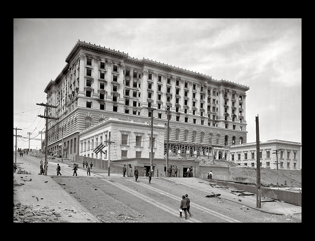
Shorpy image of "Fairmont Hotel, San Francisco, amid ruins of earthquake and fire." The hotel, near completion when disaster struck, opened the following year. 8x10 inch dry plate glass negative, Detroit Publishing Company.View full size. |
||
|
||
Shorpy image "Looking up Market St. from near Ferry." Another look at San Francisco in the aftermath of the earthquake and fire of April 18, 1906.View full size. |
||
|
||
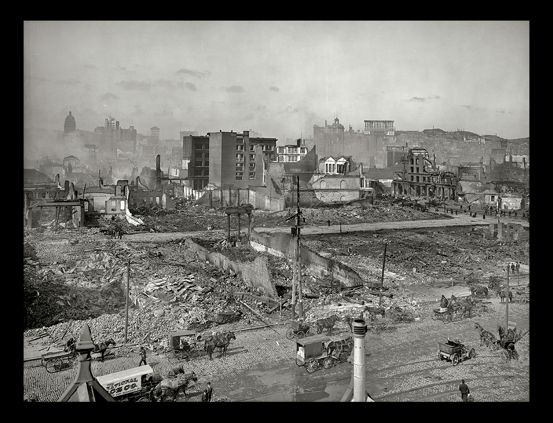
Shorpy image of "Nob Hill from roof of Ferry Post Office." San Francisco after the earthquake and fire of April 18, 1906. Detroit Publishing glass negative.View full size. |
||
|
||
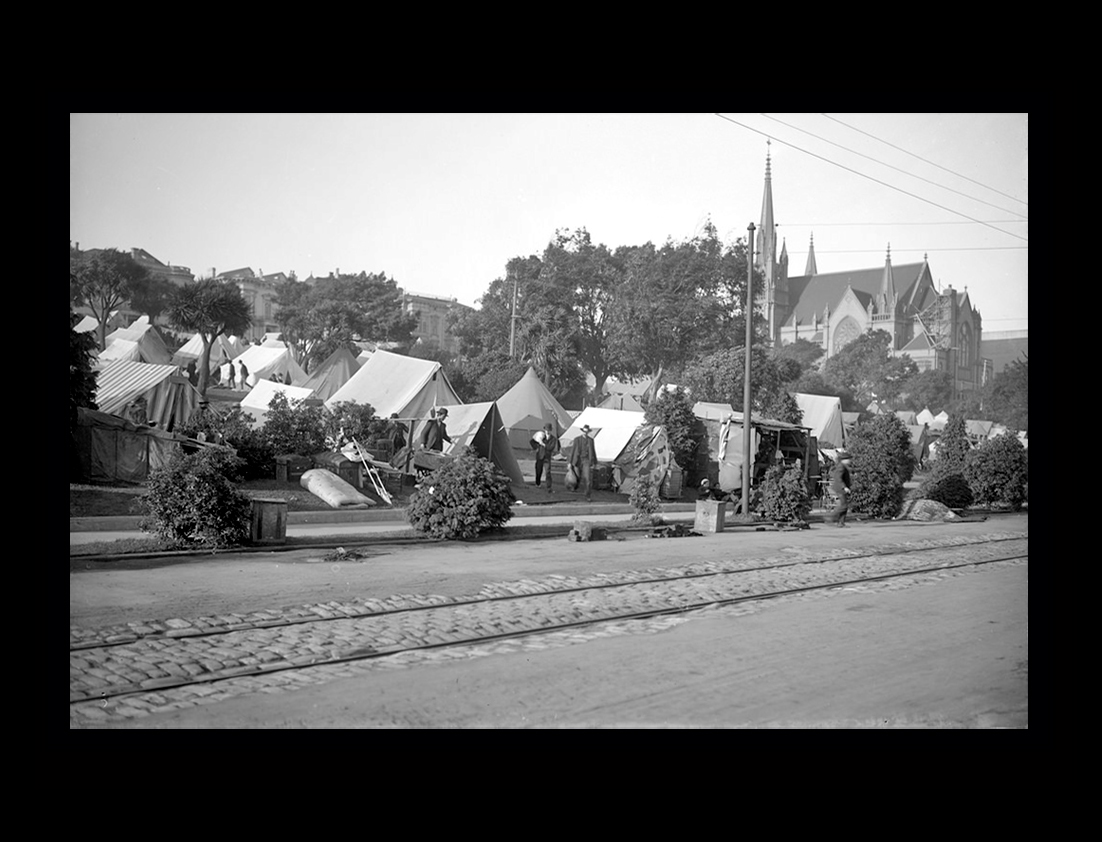
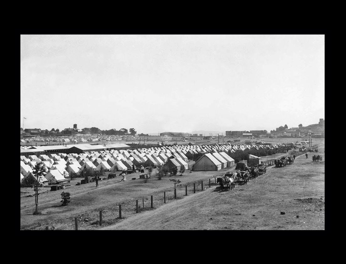
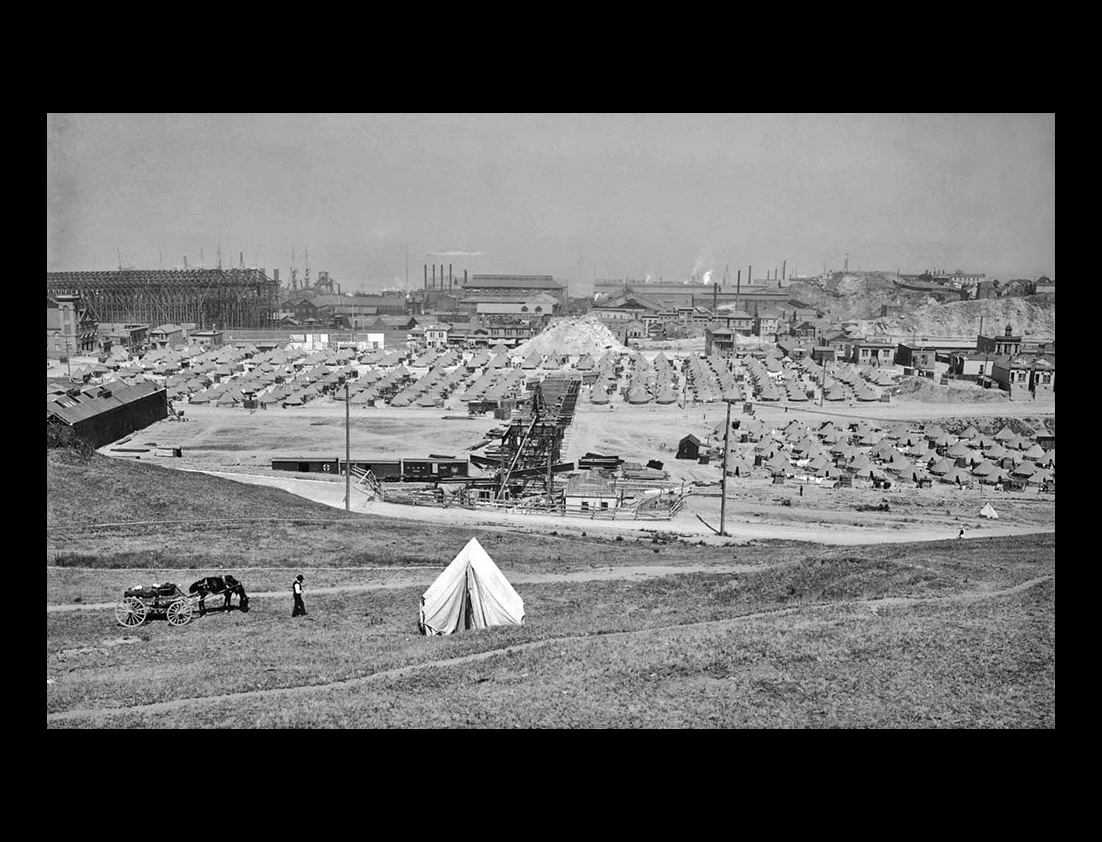
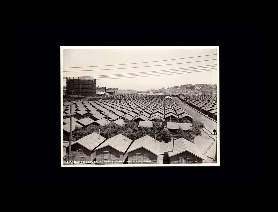
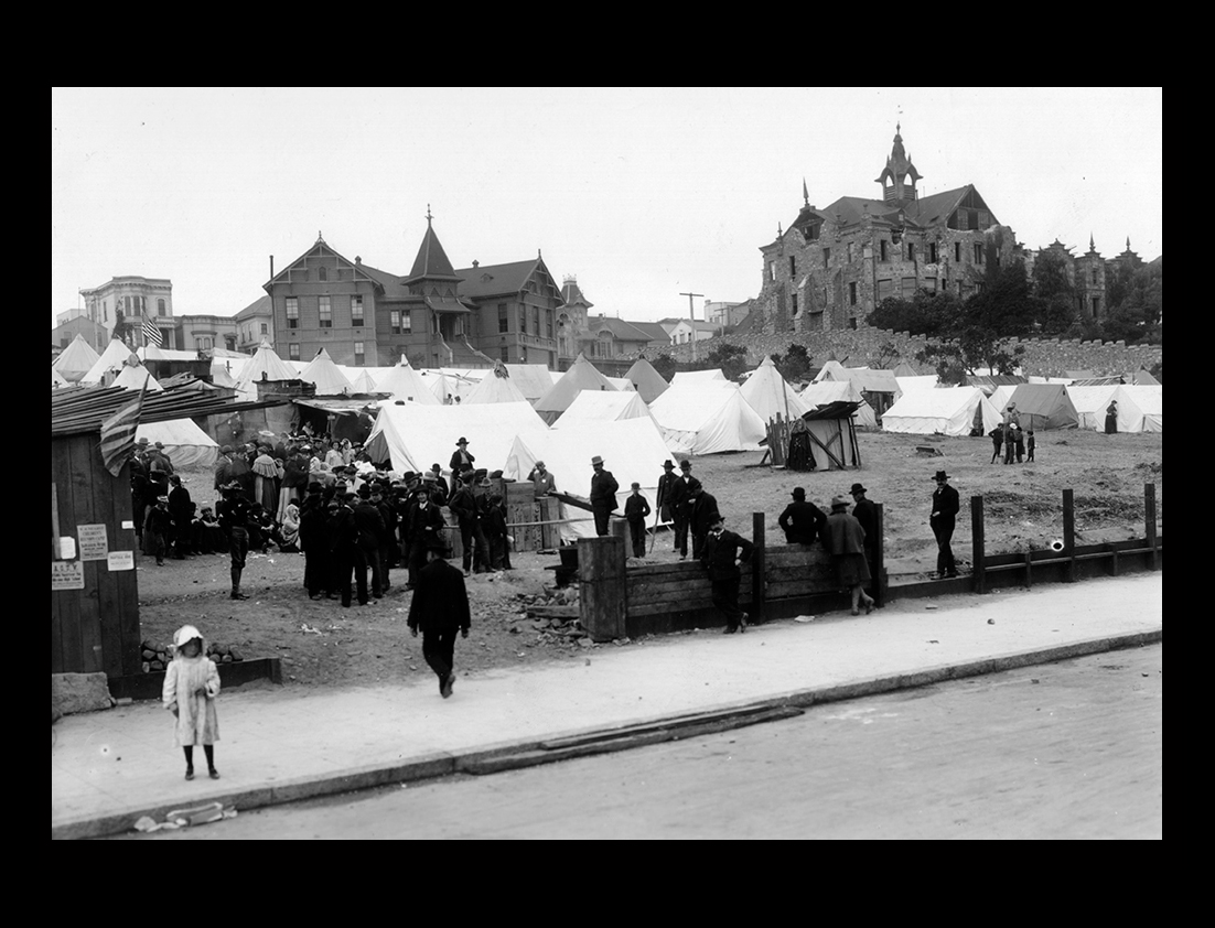
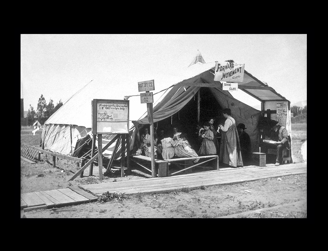
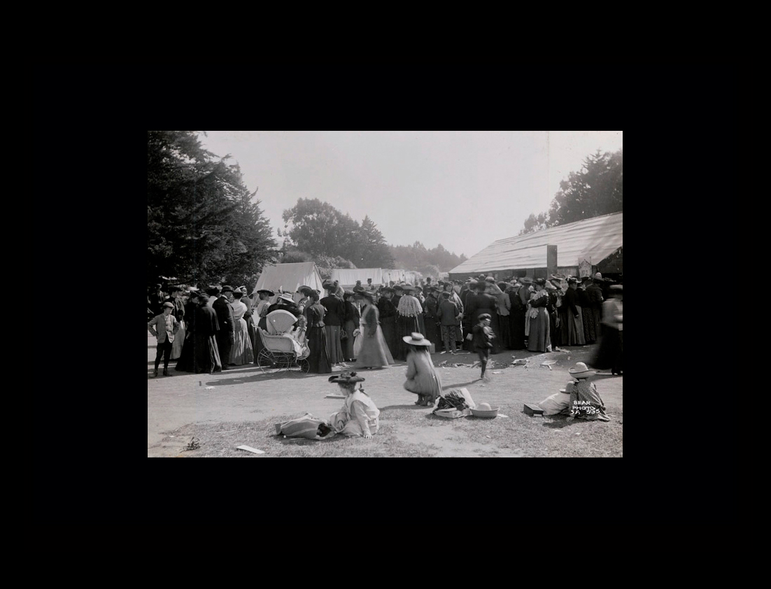
The survivors slept in tents in city parks and the Presidio, stood in long lines for food, and were required to do their cooking in the street to minimize the threat of additional fires. The San Francisco earthquake is considered one of the worst natural disasters in U.S. history. |
||
|
||
|
||
|
||
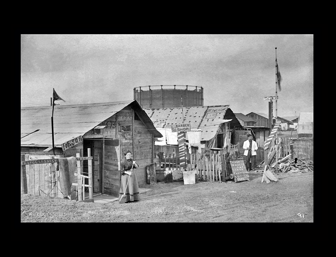
Despite the utter devastation, San Francisco quickly recovered from the earthquake, and the destruction actually allowed planners to create a new and improved city. A classic Western boomtown, San Francisco had grown in a haphazard manner since the Gold Rush of 1849. |
||
|
||
Working from a nearly clean slate, San Franciscans were able to rebuild the city with a more logical and elegant structure. The destruction of the urban center at San Francisco also encouraged the growth of new towns around the San Francisco Bay, making room for a population boom arriving from other parts of the United States and abroad. |
||
|
||
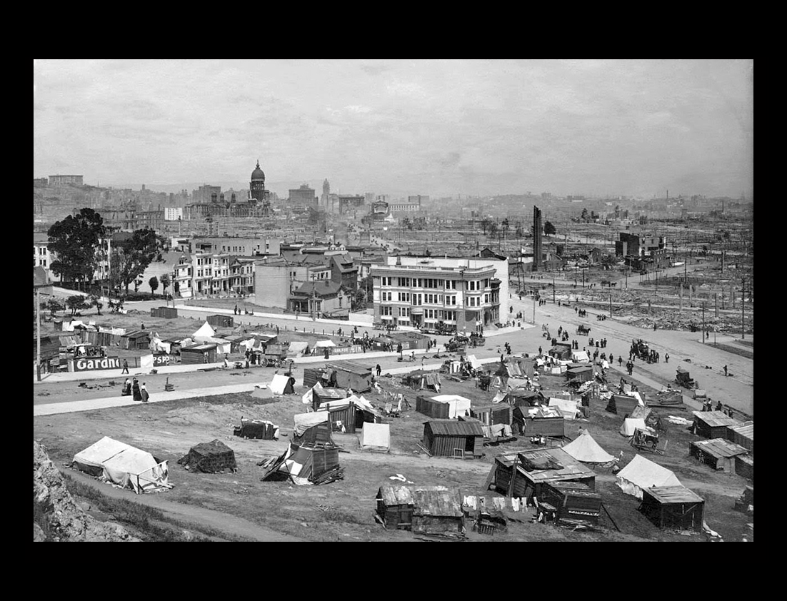
Over 250,000 refugees fled to the streets and parks in the first week of the calamity. Without money, food or even water to drink, many wandered aimlessly throughout the stricken city. Most eventually found shelter in the parks and cemeteries, the millionaire jostling elbows with the day laborer, the mistress with her maid and the professional man with the tradesman, all reduced to one common level of survival. |
||
 |
||
|
||
|
||
|
||
|
||
This is the most complete version of the historic film, "A Trip Down Market Street," combining the best elements of prints from Prelinger Arichives and Library of Congress.This twelve minute film of a cable car ride down Market Street was made on April 14th, four days before the earthquake struck.Click here:A Trip Down Market Street |
||
Newsletters Index: 2024, 2023, 2022, 2021 2020, 2019, 2018, 2017, 2016, 2015, 2014, 2013, 2012, 2011, 2010, 2009, 2008, 2007, 2006
Photography Index | Graphics Index | History Index
Home | Gallery | About Me | Links | Contact
© 2023 All rights reserved
The images oon this site are not in the public domain. They are the sole property of the
artist and may not be reproduced on the Internet, sold, altered, enhanced,
modified by artificial, digital or computer imaging or in any other form
without the express written permission of the artist. Non-watermarked copies of photographs on this site can be purchased by contacting Ron.