RON HENGGELER |
July 14, 2013
The Bay Model in Sausalito
After a two-year renovation, the Bay Model in Sausalito reopened in February of 2012.
The Bay Model was built by the Army Corps of Engineers in 1957 as a way to examine the impact of a proposed dam system would have had on the San Francisco Bay.
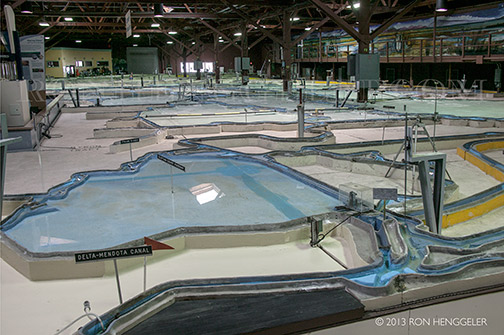
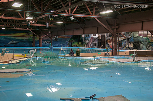
The Bay Model has functioned solely as an educational facility since 2000, and visitors can marvel at the giant model itself, which is the size of two football fields, learn about the local ecosystem, and explore the history of the World War II-era Marinship shipyard that was once on the site. |
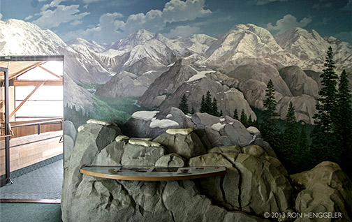
Upon first entering the Bay Model, a visitor sees a short introductory video showing the waterways of San Francisco Bay and the history and purpose of the model. |
The model was originally created to demonstrate and study the delicately interlinked natural and man-made systems that bring fresh water from the Sierra Nevada, down rivers and creeks, to meet the salt water of the Pacific Ocean. |
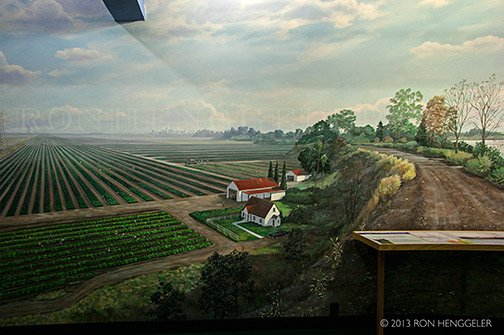
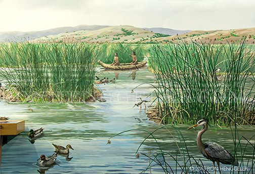
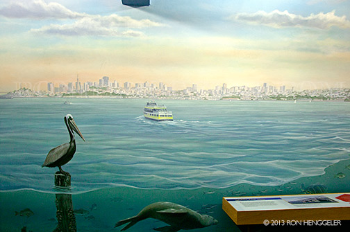
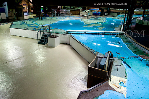
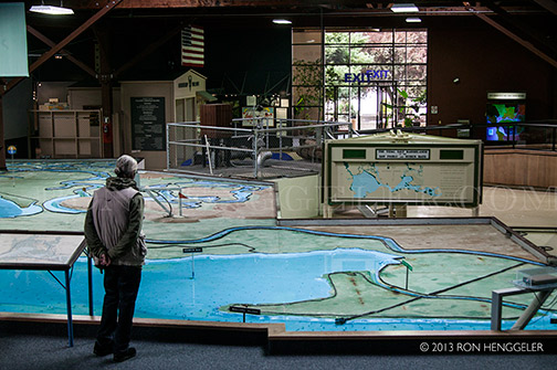
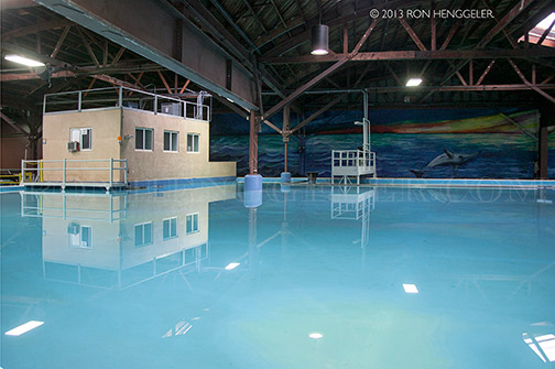
Visitors who stroll through the two-acre building will find interactive educational exhibits and interpretive murals that help explain what they’re seeing. |
This fascinating and unique facility is one of the Bay Area's best open secrets. |
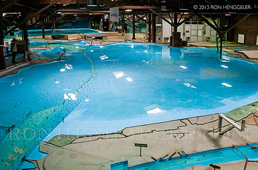
At first sight, the San Francisco Bay Model is utterly overwhelming. |
|
|
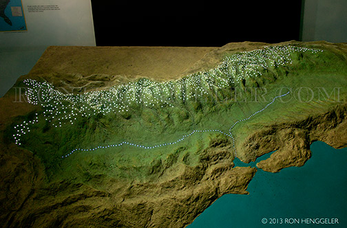
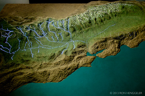
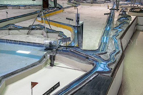
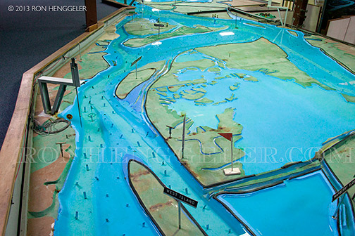
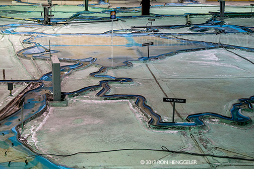
The U.S. Army Corps of Engineers Bay Model is a working hydraulic scale model of the San Francisco Bay and Sacramento-San Joaquin River Delta System. |
The Bay Model is still operational but no longer used for scientific research. |
In the late 1940s, John Reber proposed to build two large dams in the San Francisco Bay as a way to provide a more reliable water supply to residents and farms and to connect local communities. Authorized by Section 110 of the Rivers and Harbors Act of 1950, the Bay Model was constructed in 1957 to study the plan. The tests proved that the plan was not viable, and the Reber Plan was scuttled. |
|
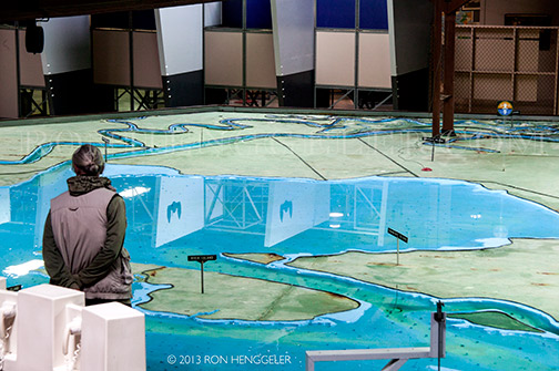
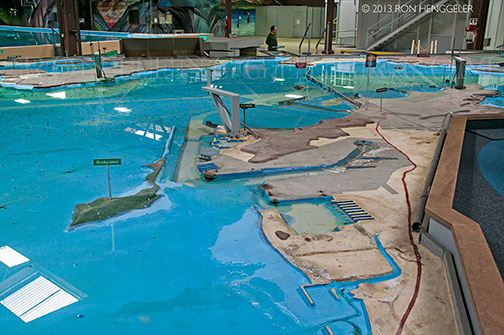
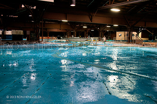
Standing on the observation platform, above the acre-and-a-half scale reconstruction of the Bay Area's waterways, a viewer can scan from the Sacramento-San Joaquin River Delta across San Pablo Bay to the Pacific Ocean. |
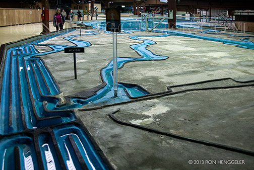
Special walkways allow visitors to walk around in the middle of the model, not just at the edges. |
|
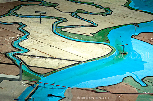
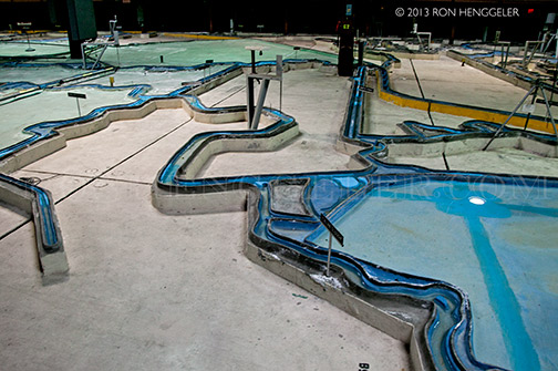
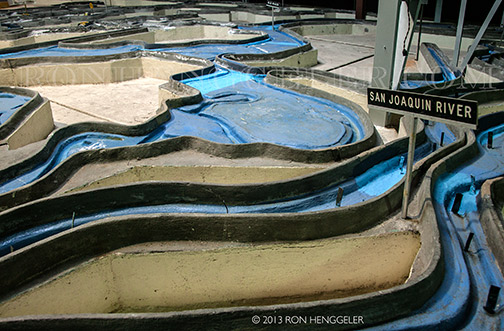
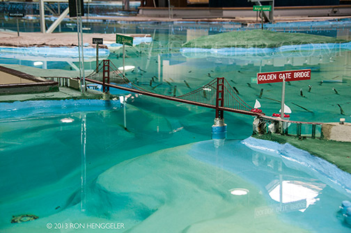
The limits of the model encompass the Pacific Ocean extending 17 miles beyond the Golden Gate, San Francisco Bay, San Pablo Bay, Suisun Bay and all of the Sacramento-San Joaquin River Delta to Verona, 17 miles north of Sacramento on the north, and to Vernalis, 32 miles south of Stockton on the San Joaquin River on the south. |
|
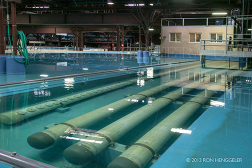
The model is approximately 320 feet long in the north-south direction and about 400 feet long in the east-west direction. |
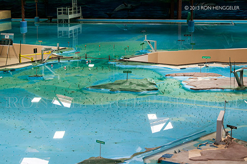
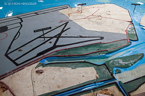
Detail of the Bay Model’s Oakland Airport |
It is constructed out of 286 five-ton concrete slabs joined together like a jigsaw puzzle. |
|
|
|
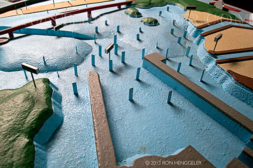
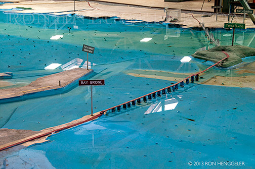
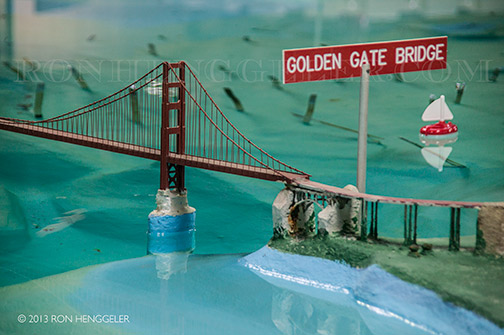
Features that affect the water flow of the San Francisco Bay and Sacramento-San Joaquin Delta are reproduced, including ship channels, rivers, creeks, sloughs, the canals in the Delta, fills, major wharfs, piers, slips, dikes, bridges, and breakwaters. |
|
|
If one watches carefully, one can actually see the water flowing through the Golden Gate. |
|
Clever pumping systems enable hundreds of thousands of gallons of water to ebb and flow in tides that cycle every 14 minutes. |
The Bay Model and the Bay Model Visitor Center is a research and education facility built and managed by the U.S. Army Corps of Engineers. |
Newsletters Index: 2015, 2014, 2013, 2012, 2011, 2010, 2009, 2008, 2007, 2006
Photography Index | Graphics Index | History Index
Home | Gallery | About Me | Links | Contact
© 2015 All rights reserved
The images are not in the public domain. They are the sole property of the
artist and may not be reproduced on the Internet, sold, altered, enhanced,
modified by artificial, digital or computer imaging or in any other form
without the express written permission of the artist. Non-watermarked copies of photographs on this site can be purchased by contacting Ron.