RON HENGGELER |
December 5, 2011
Images of Point Reyes in the winter
Point Reyes is a prominent cape and popular Northern California tourist destination on the Pacific coast of northern California. It is located in Marin County approximately 30 miles west-northwest of San Francisco. The term is often applied to the Point Reyes Peninsula, the region bounded by Tomales Bay on the northeast and Bolinas Lagoon on the southeast. The headland is protected as part of Point Reyes National Seashore.
The Spanish explorer Sebastián Vizcaíno named the land Punto de los Reyes ("Kings' Point") when his ship, the Capitana anchored in Drakes Bay on the Day of the Three Kings (Epiphany, or the end of the 12 Days of Christmas) on January 6, 1603.
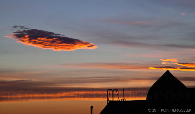
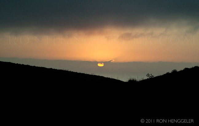
Sunrise from my window |
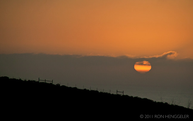
Sunrise from my window |
Hermina, Janis, and Francisco |
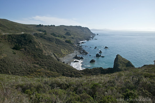
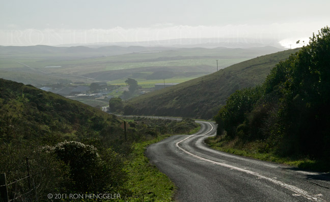
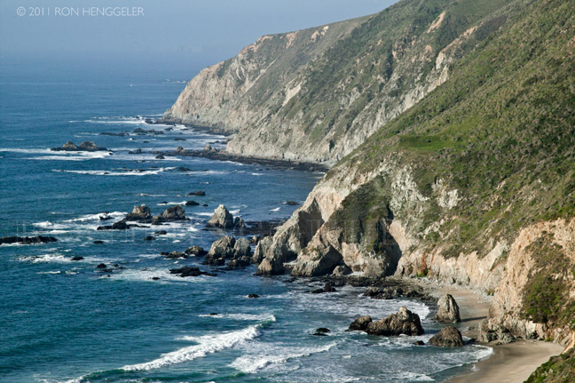
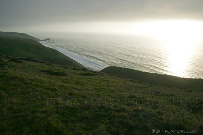
A view looking south to the Gate from Highway One |
A view looking south to the Gate from Highway One |
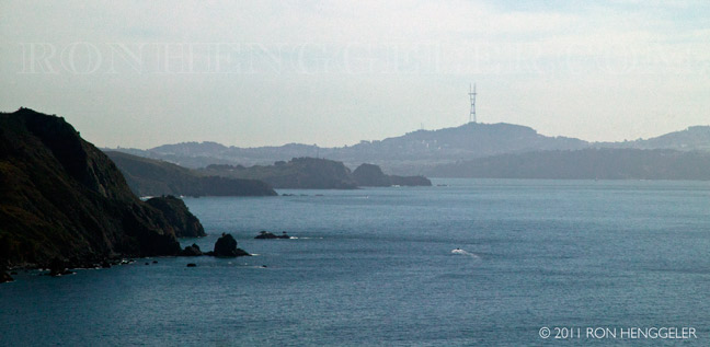
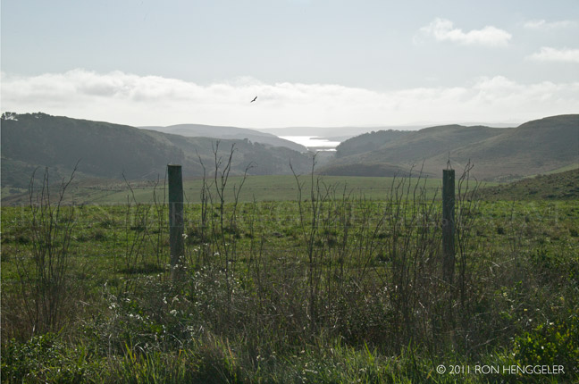
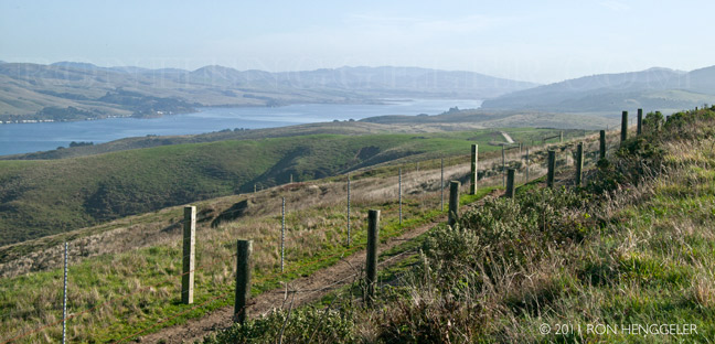
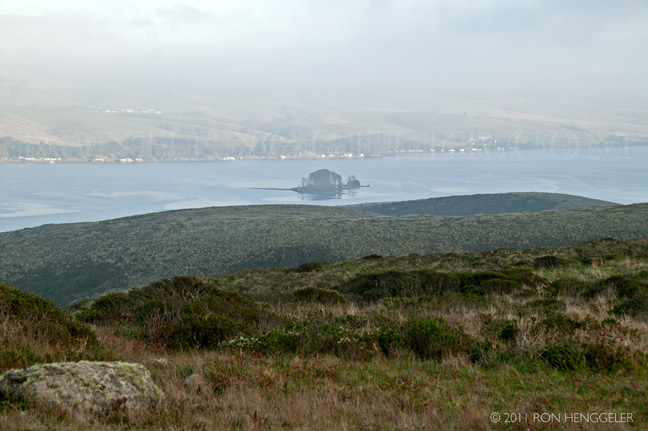
The southern end of Tomales Bay |
A view of Drakes Estero from Sir Francis Drake Blvd. in the Point Reyes National Seashore The cape protects Drakes Bay on its southern side. The headland is largely drained by Drakes Estero. Drakes Bay and Drake's Estero are named after English seafarer Sir Francis Drake who possibly hauled his ship, the Golden Hinde, up onto the beach for repairs in June 1579. Inverness Ridge runs along the peninsula's northwest-southeast spine, with forested peaks around 430 meters (1,400 ft). West of the ridge, the land flattens out and the vegetation turns to scrub. The Mount Vision fire in 1995 burned part of Inverness Ridge. Point Reyes lends its name to the town of Point Reyes Station, California. |
Looking south to the Pastoral Lands from the Pierce Ranch Road The entire Point Reyes Peninsula is a piece of the Salinian Block transported northward by the San Andreas Fault. Its core is granite, unlike the terrain east of Tomales Bay. The granite rocks that form the peninsula were once continuous with the Tehachapi Mountains 350 miles south. In the 1906 earthquake, Point Reyes moved north 21 feet. Point Reyes is bounded to the east by the San Andreas Fault, which runs directly under Tomales Bay, and is structurally dominated by the Point Reyes Syncline. The Point Reyes Peninsula is on the Pacific Plate, while the rest of Marin County land is on the North American Plate. The peninsula is a member of the Salinian Terrane, a segment of the southernmost Sierra Nevada range transported north from Southern California by movement along the San Andreas fault. Simply speaking the peninsula consists of three major members: the Salinian Cretaceous crystalline basement, the overlying Pliocene sedimentary rocks, and the late Pleistocene marine terrace deposits of the southern peninsula. |
Tomales Bay seen fromthe PierceRanch Road |
The Caldron on McClure's Beach in the Point Reyes National Seashore seen from the Tomales Head Trail McClures Beach is the northern most accessible beach in Point Reyes National Seashore, an idyllic crescent framed by towering bluffs and pounding waves. |
McClure's Beach in the Point Reyes National Seashore seen from the Tomales Head Trail Distance from the main visitor center keeps crowds to a minimum in this tranquil corner of the Park. Swimming, wading and surfing are not permitted at McClures Beach due to strong surf and active White Shark populations just off shore. |
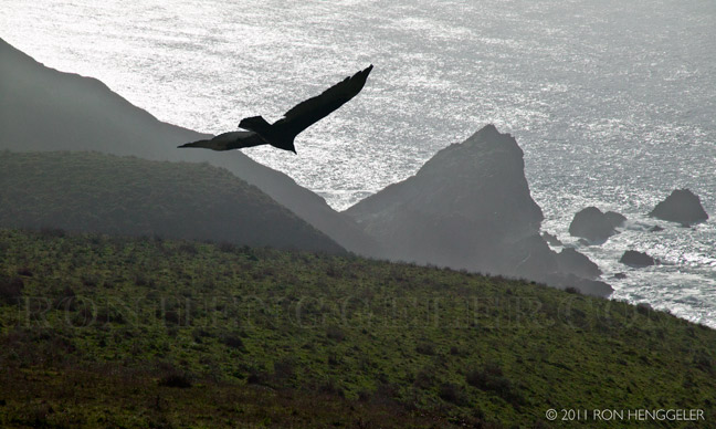
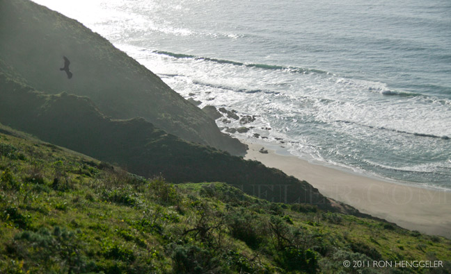
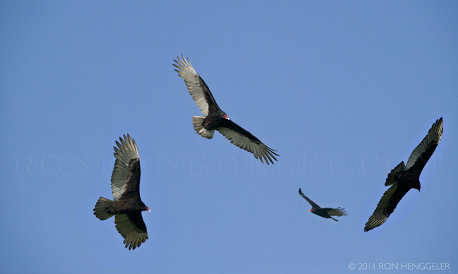
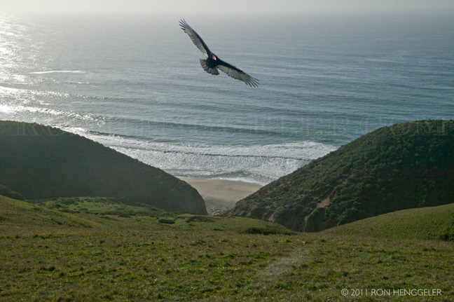
Point Reyes has a great variety of birds that live here year round as well as those passing by on migratory paths or just visiting for the wintering season. Nearly 490 species of birds have been counted in Point Reyes making it a haven for birdwatching enthusiasts. Turkey Vultures are conspicuous all around the area as they fly to soaring heights with their red bald heads and long wingspan. |
A view looking north to the coastal cliffs as seen from the Tomales Head Trail Point Reyes' first inhabitants, the Coast Miwok, lived on the land for thousands of years.They left evidence of well over a hundred encampments on the peninsula, with a population estimated to have been nearly 3,000. Seasonal hunters and gatherers, rather than cultivators, they were nourished by fish, clams, mussels, and crab, in addition to the deer, elk, bear, mud hen, geese, and small game they hunted with spears and bows. Although they did not cultivate the land, they used the plentiful acorns as a staple part of their diet by removing the tannic acid and making a pulp that was stored in dry granaries. Although the exact location of Sir Francis Drake's 1579 anchorage at Point Reyes is still being debated, evidence has confirmed that he landed near a Coast Miwok settlement. Observations, presumably written by his chaplain, describe the genial welcome Drake and his men received, complete with ceremony and gifts. The Coast Miwok continued their peaceful existence until late in the 18th century when the Spanish built Mission San Rafael and padres began journeying to Point Reyes to recruit them to move to the mission. While attempting to convert them, these padres disrupted their traditional way of life in addition to inadvertently introducing diseases that brought untimely deaths, fewer births, and significantly increasing infant mortality rates. |
In 1992, Coast Miwok descendants established the Federated Indians of Graton Rancheria and, by 2001, had 400 members who could prove their descent from local tribes. Today, they enjoy a rebirth of traditional customs and ceremonies, often held in Kule Loklo, "Valley of the Bear", a replica Miwok village in Point Reyes National Seashore. |
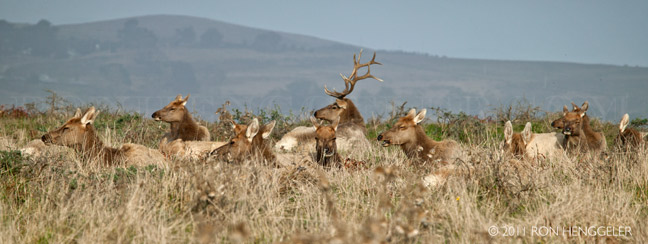
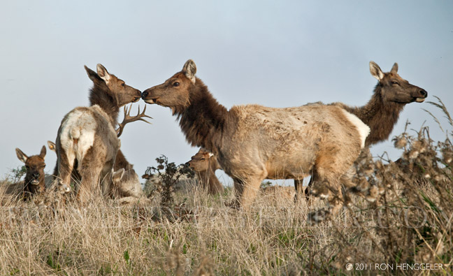
Tule Elk seen along the Tomales Head Trail in the Point Reyes National Seashore In 1978, ten Tule Elk (Cervus canadensis ssp. nannodes) were re-introduced to Point Reyes from the San Luis National Wildlife Refuge near Los Banos. By 2009, over 440 elk were counted at Tomales Point's 2,600 acres of coastal scrub and grasslands. In 1999, one hundred of the Tomales Point elk were moved to roam free in the Limantour wilderness area of the Seashore and above Drakes Beach. The tule elk and the native black-tailed deer had been hunted, and the population of the black-tailed deer had also been suppressed by two introduced competitors, axis deer and fallow deer. |
Tule Elk seen along the Tomales Head Trail in the Point Reyes National Seashore
|
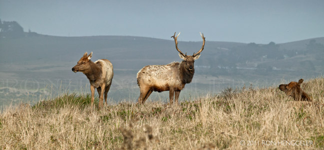
Tule Elk seen along the Tomales Head Trail in the Point Reyes National Seashore |
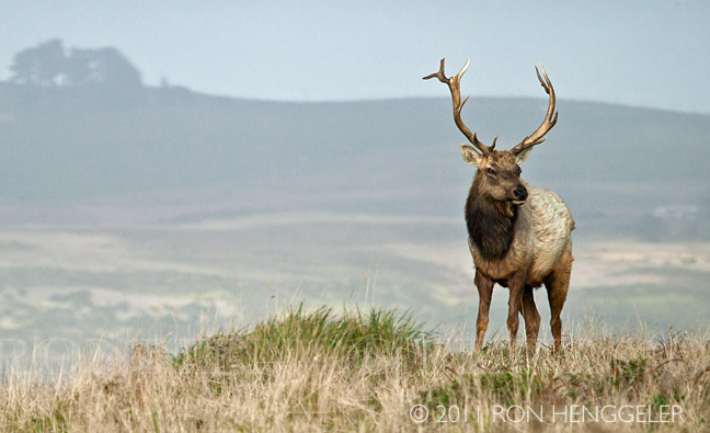
Tule Elk seen along the Tomales Head Trail in the Point Reyes National Seashore |
Hog Island in Tomales Bay seen along the Tomales Head Trail in the Point Reyes National Seashore Hog Island is an island roughly 2 acres in size located approximately 5 miles south of the entrance to Tomales Bay in the West Marin area of Marin County, California. While waters to its west are deep enough for small ships to enter Tomales Bay, at low tide the shallows to the east may be wadeable to the eastern shore of the bay. Unsuspecting vessels have run aground in that region a number of times. However, as it is some distance from the mouth of Tomales Bay, Hog Island does not experience the large sudden waves that characterize the Tomales Bay Bar entrance region. The name Hog Island reportedly came from a bizarre 1870s incident when a barge carrying a load of pigs caught fire and was grounded on the island to avoid sinking, at which point the pigs escaped onto the island until they were rounded up again. The island lends its name to the Hog Island Oyster Company, which produces shellfish on Tomales Bay, several miles south of Hog Island. The San Andreas fault runs through the center of Tomales Bay, past Hog Island. Local legend has it that Hog Island and nearby Duck Island (also known as "Piglet") were once connected, but separated as a result of the 1906 San Francisco earthquake. Despite the legend, land deeds from the 1880s indicate that the two islands were separate before the earthquake. The two islands have been intermittently linked by a sand spit exposed at low tide, including at the current time. The Inverness Yacht Club hosts an annual sailboat race around the island. Competing boats sail from the club, around the island, and back to the club again. |
McClure's Beach in the Point Reyes National Seashore seen from the Tomales Head Trail Hazards notwithstanding this is arguably one of Point Reyes' most compelling beaches for its size, scenery and location: The trail drops sharply from the parking area down a steep, narrow ravine and merges with another in .17 miles. The steep grade continues to the beach (.4 miles), where it spills into its approximate center. The north end of McClures Beach is hemmed by outcrops, but a narrow slot on the south end - safely navigable at low tide - threads the bluffs and Elephant Rock to a secluded cove with sea stacks just offshore. |
David on the Tomales Head Trail |
David at the historic Pierce Ranch in the Point Reyes National Seashore |
Sunset at McClure's Beach in the Point Reyes National Seashore |
Sunset at McClure's Beach in the Point Reyes National Seashore |


Newsletters Index: 2015, 2014, 2013, 2012, 2011, 2010, 2009, 2008, 2007, 2006
Photography Index | Graphics Index | History Index
Home | Gallery | About Me | Links | Contact
© 2015 All rights reserved
The images are not in the public domain. They are the sole property of the
artist and may not be reproduced on the Internet, sold, altered, enhanced,
modified by artificial, digital or computer imaging or in any other form
without the express written permission of the artist. Non-watermarked copies of photographs on this site can be purchased by contacting Ron.